Bar nearby The Boot Inn
Ireland
Bar nearby The Boot Inn
The Boot Inn
Cloghran, R108, Huntstown, Dublin Irland
contacts phone
:
+353
Latitude:
53.4319089
, Longitude:
-6.2642911
read more
nearest Bar
1.384 km
The Angel's Share
Terminal 1, Dublin Airport, DUblin
Bar
read more
1.387 km
Gate Clock Bar
Dublin 1
Bar
read more
1.733 km
The Slaney
Terminal 2, Dublin Airport, Swords, Dublin
Bar
read more
2.325 km
The Coachmans Inn
Airport Road, Cloughran, Dublin
Bar
read more
2.4 km
Kealy's
Swords Road, Cloghran, Dublin
Bar
read more
2.448 km
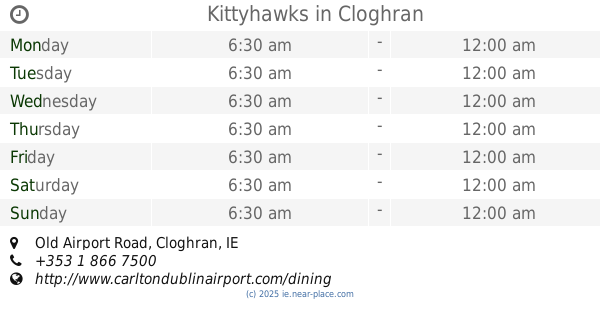
Kittyhawks
Old Airport Road, Cloghran
Bar
read more
2.697 km
Peacocks Bar and Lounge
Rivervalley Shopping Centre, Swords, Co. Dublin, Swords, Dublin
Bar
read more
3.291 km
Bar & Restaurant
Crowscastle, Swords
Bar
read more
3.55 km
old finglas castle
Meakstown, Dublin
Bar
read more
3.724 km
The Lord Mayors
Main Street, Swords
Bar
read more
3.75 km
The Well Cafe Bar & Grill
1 Dublin Road, Swords
Bar
read more
3.868 km
The Chalk Venue
Glebe, Swords
Bar
read more
3.868 km
The Chalk Bar
Glebe, Swords
Bar
read more
3.886 km
The Old Schoolhouse Bar & Restaurant
Church Road, Swords
Bar
read more
3.904 km
The Old Borough
72 Main Street, Swords
Bar
read more
3.922 km
The Metzo Bar
Shangan Road, Dublin
Bar
read more
3.96 km
Wrights Cafe Bar
The Plaza, Malahide Road, Swords
Bar
read more
3.964 km
Ruby's Pizza & Grill
Pavilions Shopping Centre, Malahide Road, Swords, Swords
Bar
read more
4.093 km
The Cock Tavern
31 Main Street, Swords
Bar
read more
4.123 km
Cafe Tara
20 Main Street, Swords
Bar
read more
4.187 km
The Swiss Cottage bar & lounge
The Swiss Cottage, Swords Road, Santry, Dublin
Bar
read more
4.202 km
The Pound / The Attic Bar
Bridge Street, Townparks, Swords
Bar
read more
4.532 km
Astro Park
17 Coolock Lane, Kilmore, Dublin 17
Bar
read more
4.912 km
Kilmardinny Inn
Lorcan Avenue, Whitehall, Dublin
Bar
read more
4.976 km
The Comet
243 Swords Road, Whitehall, Dublin
Bar
read more
📑
all categories
Accounting
Administrative area level 1
Administrative area level 2
Airport
Amusement park
Aquarium
Art gallery
Atm
Bakery
Bank
Bar
Beauty salon
Bicycle store
Book store
Bowling alley
Bus station
Cafe
Campground
Car dealer
Car rental
Car repair
Car wash
Casino
Cemetery
Church
City hall
Clothing store
Colloquial area
Convenience store
Country
Courthouse
Dentist
Department store
Doctor
Electrician
Electronics store
Embassy
Establishment
Finance
Fire station
Florist
Food
Funeral home
Furniture store
Gas station
General contractor
Grocery or supermarket
Gym
Hair care
Hardware store
Health
Hindu Temple
Home goods store
Hospital
Insurance agency
Jewelry store
Laundry
Lawyer
Library
Light rail station
Liquor store
Local government office
Locality
Locksmith
Lodging
Meal delivery
Meal takeaway
Mosque
Movie rental
Movie theater
Moving company
Museum
Natural feature
Neighborhood
Night club
Painter
Park
Parking
Pet store
Pharmacy
Physiotherapist
Place of worship
Plumber
Point of interest
Police
Political
Post office
Premise
Real estate agency
Restaurant
Roofing contractor
Route
Rv park, camping
School
Shoe store
Shopping mall
Spa
Stadium
Storage
Store
Sublocality
Subpremise
Supermarket
Synagogue
Taxi stand
Train station
Transit station
Travel agency
University
Veterinary care
Zoo
sublocality level 1
↑