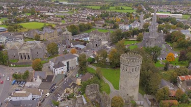
Locality nearby Racecourse Retail Park
Coronavirus disease (COVID-19) Situation
confirmed cases
1734582
deaths
9491
Ireland
Locality nearby Racecourse Retail Park
Racecourse Retail Park
Racecourse, Racecourse Retail Park, Co. Tipperary, Irland
contacts phone
:
+353
Latitude:
52.68541
, Longitude:
-7.83353
larger map & directions
read more
nearest Locality
963 m
Killinan
Killinan
Locality
read more
5.467 km
Gortnagow
Gortnagow
Locality
read more
5.644 km
Holycross
Holycross
Locality
read more
27.412 km
Newinn
Newinn
Locality
read more
27.582 km
Our lady's Road
Our lady's Road
Locality
read more
29.877 km
Freshford
Freshford
Locality
read more
31.544 km
Nenagh
Nenagh
Locality
read more
31.86 km
Gortavalla Business Park
Gortavalla Business Park
Locality
read more
31.917 km
Tipperary
Tipperary
Locality
read more
32.286 km
Tubrid
Tubrid
Locality
read more
32.612 km
Limerick Junction
Limerick Junction
Locality
read more
35.585 km
Cullen
Cullen
Locality
read more
38.537 km
Theresa Ahearn Close
Theresa Ahearn Close
Locality
read more
38.545 km
Grange
Grange
Locality
read more
41.962 km
Ardfinnan
Ardfinnan
Locality
read more
42.189 km
Cillín Hill Agri-Business Park
Cillín Hill Agri-Business Park
Locality
read more
43.502 km
Rock Lane
Rock Lane
Locality
read more
43.602 km
Crinkill
Crinkill
Locality
read more
46.197 km
Clonmel Road
Clonmel Road
Locality
read more
52.029 km
Cappoley Lane
Cappoley Lane
Locality
read more
52.128 km
Sheffield Cross
Sheffield Cross
Locality
read more
52.729 km
Portlaoise
Portlaoise
Locality
read more
58.905 km
Mountmellick
Mountmellick
Locality
read more
59.001 km
Hightown
Hightown
Locality
read more
68.152 km
Waterford
Waterford
Locality
read more
📑
all categories
Accounting
Administrative area level 1
Administrative area level 2
Airport
Amusement park
Aquarium
Art gallery
Atm
Bakery
Bank
Bar
Beauty salon
Bicycle store
Book store
Bowling alley
Bus station
Cafe
Campground
Car dealer
Car rental
Car repair
Car wash
Casino
Cemetery
Church
City hall
Clothing store
Colloquial area
Convenience store
Country
Courthouse
Dentist
Department store
Doctor
Electrician
Electronics store
Embassy
Establishment
Finance
Fire station
Florist
Food
Funeral home
Furniture store
Gas station
General contractor
Grocery or supermarket
Gym
Hair care
Hardware store
Health
Hindu Temple
Home goods store
Hospital
Insurance agency
Jewelry store
Laundry
Lawyer
Library
Light rail station
Liquor store
Local government office
Locality
Locksmith
Lodging
Meal delivery
Meal takeaway
Mosque
Movie rental
Movie theater
Moving company
Museum
Natural feature
Neighborhood
Night club
Painter
Park
Parking
Pet store
Pharmacy
Physiotherapist
Place of worship
Plumber
Point of interest
Police
Political
Post office
Premise
Real estate agency
Restaurant
Roofing contractor
Route
Rv park, camping
School
Shoe store
Shopping mall
Spa
Stadium
Storage
Store
Sublocality
Subpremise
Supermarket
Synagogue
Taxi stand
Train station
Transit station
Travel agency
University
Veterinary care
Zoo
sublocality level 1
↑