Lodging nearby North County House
Coronavirus disease (COVID-19) Situation
confirmed cases
1734582
deaths
9491
Ireland
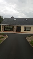
Lodging nearby North County House
North County House
67 Church Street, Listowel Ireland
contacts phone
:
+353
Latitude:
52.4469821
, Longitude:
-9.4833807
read more
nearest Lodging
75 m
McMahon Guest House
40 Church Street, Listowel
Lodging
read more
203 m
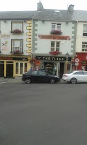
Behan's Horseshoe Bar & Restaurant
14 William Street, Listowel
Lodging
read more
259 m
Gurtenard House
2 Woodlawn, Listowel
Lodging
read more
307 m
Listowel Arms Hotel
The Square, Listowel
Lodging
read more
821 m
Ruah Cottage
Coolaclarig, Listowel, Co. Kerry. Ireland, Listowel
Lodging
read more
1.254 km
B&B 7 Ashfield
7 Ashfield, Greenville, Listowel
Lodging
read more
1.35 km
Derry House
Cahirdown Close, Listowel
Lodging
read more
1.591 km
KerryHouse45
45 Cahirdown Wood, Dromin Lower, Listowel
Lodging
read more
2.26 km
Millstream House
Listowel
Lodging
read more
2.433 km
Halpin's Self Catering
Halpin's, Coolatoosane, Listowel
Lodging
read more
3.074 km
Palmgrove House B&B
Tarbert Road, Listowel
Lodging
read more
3.533 km
Billeragh House
Billeragh
Lodging
read more
5.45 km
Coolard
Listowel, go kerry Gunsborugh, listowel, Gunsborough
Lodging
read more
7.11 km
Villa Maira - Country Cottage
Villa Maria, Kealid, Newtown Sandes
Lodging
read more
12.287 km
Unique Country Farm House
Road Ballyduff, Tralee
Lodging
read more
13.035 km
Banna Beach
R557
Lodging
read more
17.214 km
Breenville Farm House
Laccamore Kilfynn, Tralee
Lodging
read more
17.992 km
Shealane House
Bridge Road, Corha-Mor, Valentia Island
Lodging
read more
23.892 km
Cois Li Bed and breakfast
Curraghleha Eircode: V92RX03 Tralee, Tralee
Lodging
read more
23.934 km
Hotel Ballyseede Castle
Ireland
Lodging
read more
24.206 km
Manorlodge
Kilarney Road Rathass, N21, Manor West, Tralee
Lodging
read more
24.979 km
Finnegans
17 Denny Street, Tralee
Lodging
read more
25.053 km
Castlemorris House B&B
Ballymullen, Tralee
Lodging
read more
26.113 km
Ard na Coille
An Choill, Tralee
Lodging
read more
26.31 km
Home
47 Ashgrove, Tralee
Lodging
read more
📑
all categories
Accounting
Administrative area level 1
Administrative area level 2
Airport
Amusement park
Aquarium
Art gallery
Atm
Bakery
Bank
Bar
Beauty salon
Bicycle store
Book store
Bowling alley
Bus station
Cafe
Campground
Car dealer
Car rental
Car repair
Car wash
Casino
Cemetery
Church
City hall
Clothing store
Colloquial area
Convenience store
Country
Courthouse
Dentist
Department store
Doctor
Electrician
Electronics store
Embassy
Establishment
Finance
Fire station
Florist
Food
Funeral home
Furniture store
Gas station
General contractor
Grocery or supermarket
Gym
Hair care
Hardware store
Health
Hindu Temple
Home goods store
Hospital
Insurance agency
Jewelry store
Laundry
Lawyer
Library
Light rail station
Liquor store
Local government office
Locality
Locksmith
Lodging
Meal delivery
Meal takeaway
Mosque
Movie rental
Movie theater
Moving company
Museum
Natural feature
Neighborhood
Night club
Painter
Park
Parking
Pet store
Pharmacy
Physiotherapist
Place of worship
Plumber
Point of interest
Police
Political
Post office
Premise
Real estate agency
Restaurant
Roofing contractor
Route
Rv park, camping
School
Shoe store
Shopping mall
Spa
Stadium
Storage
Store
Sublocality
Subpremise
Supermarket
Synagogue
Taxi stand
Train station
Transit station
Travel agency
University
Veterinary care
Zoo
sublocality level 1
↑