places in Longford
Coronavirus disease (COVID-19) Situation
confirmed cases
1734582
deaths
9491
Ireland
Longford
Longford
Administrative Region:
County Longford
population:
10 952
calling code:
+353-43
postcode:
N39
Location on the map of Ireland
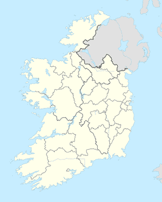
Longford
Locality
Longford
Longford
Locality
read more
Clonbalt Wood
Clonbalt Wood
Locality
read more
Lodging
Westhouse Cafe
Strokestown Road, Lissanurlan, Longford
Lodging
read more
Westhouse
Lisanurlan, Longford
Lodging
read more
Longford Arms Hotel & Spa
25 Main Street, Longford
Lodging
read more
Sancian Bed & Breakfast
Dublin Road, Longford
Lodging
read more
St Albans House B&B
Battery Road, Longford
Lodging
read more
Viewmount House
Dublin Road, Longford
Lodging
read more
Longford Country House Fine Accommodation
And Self Catering Cottages, Enybegs, Longford
Lodging
read more
Melview Fishing Lodge
Drumlish Road, Longford
Lodging
read more
Augherea Guest House
Aghareagh, Longford
Lodging
read more
Edgeworth Hall
Apartment 8, Edgeworth Hall, Woodville Place, Prospect Wood, Longford
Lodging
read more
Cathedral View Apartments
Keons Terrace, Dublin Road, Longford
Lodging
read more
Casa Madiera
Shroid Lissardowlan, Longford
Lodging
read more
Home From Home
4, Cois Abhann, Cloondara
Lodging
read more
Keenans Hotel
1 Bally-Too-Manor, Termonbarry
Lodging
read more
Still Haven Boutique
1 River View, Termonbarry
Lodging
read more
Richmond Inn
Cloondara
Lodging
read more
Meal delivery
Pizza Hut Delivery Longford
N4 Axis Centre, Battery Road, Longford
Meal delivery
read more
Meal takeaway
Apache
8-, 11 Main Street, Deanscurragh, Longford
Meal takeaway
read more
Zam Zam
Earl Street, Longford
Meal takeaway
read more
Deli Burger
25 Ballymahon Street, Longford
Meal takeaway
read more
Sunshine
Deanscurragh, Longford
Meal takeaway
read more
Mosque
Longford Mosque
5-, 13 Strokestown Road, Longford
Mosque
read more
📑
Longford all categories
Accounting
Administrative area level 1
Administrative area level 2
Atm
Bakery
Bank
Bar
Beauty salon
Bicycle store
Book store
Bowling alley
Bus station
Cafe
Campground
Car dealer
Car repair
Car wash
Cemetery
Church
City hall
Clothing store
Convenience store
Dentist
Department store
Doctor
Electronics store
Finance
Food
Funeral home
Furniture store
Gas station
General contractor
Grocery or supermarket
Gym
Hair care
Hardware store
Health
Home goods store
Hospital
Insurance agency
Jewelry store
Laundry
Lawyer
Library
Local government office
Locality
Lodging
Meal delivery
Meal takeaway
Mosque
Movie rental
Movie theater
Museum
Natural feature
Neighborhood
Night club
Painter
Park
Parking
Pharmacy
Physiotherapist
Place of worship
Point of interest
Post office
Premise
Real estate agency
Restaurant
Route
School
Shoe store
Shopping mall
Stadium
Storage
Store
Supermarket
Travel agency
University
Veterinary care
sublocality level 1
↑