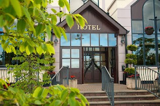
Bar nearby Glaslough
Ireland
Bar nearby Glaslough
Glaslough
Barrack Hill, Glaslough Ireland
contacts phone
:
+353
Latitude:
54.3199706
, Longitude:
-6.8980835
read more
nearest Bar
351 m
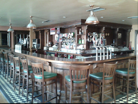
The Coachhouse & Olde Bar
2 New Line
Bar
read more
4.654 km
Hughes E C
2 Main Street, Middletown, Armagh
Bar
read more
5.217 km
Caledon Arms Hotel
44 Main Street, Caledon
Bar
read more
5.893 km
Tyholland Community Centre
N12
Bar
read more
7.892 km
Four Seasons Hotel & Leisure Club, Monaghan
Coolshannagh, Monaghan
Bar
read more
8.055 km
Jacks' Bar
Tedavnet
Bar
read more
8.065 km
The Rock Inn
Tedavnet
Bar
read more
8.402 km
Digbys Bar & Restaurant
53 Main Street, Killylea, Armagh
Bar
read more
9.169 km
The Squealing Pig Bar & Restaurant
The Diamond, Monaghan
Bar
read more
9.17 km
McManus Cozy Bar & Lounge
Glaslough Street, Roosky, Monaghan
Bar
read more
9.175 km
Mc Kenna's Bar
62 Dublin Street, Monaghan Town, Co. Monaghan, Ireland
Bar
read more
9.194 km
Mickey Micks
24 Dublin Street, Tirkeenan, Monaghan
Bar
read more
9.198 km
Shambles Bar
32 Dublin St, Monaghan
Bar
read more
9.258 km
Jimmys
7 Mill Street, Monaghan
Bar
read more
9.281 km
Courthouse Bar & Lounge
14 Cearnóg an Teampaill, Muineachán
Bar
read more
9.301 km
Rossmore Furniture & Carpets
Dublin Road, Monaghan
Bar
read more
9.342 km
Terry's Bar
6 Market Street, Monaghan
Bar
read more
9.456 km
Tir na nOg
6-7 Park Street, Monaghan
Bar
read more
11.947 km
Moyna's
Carrowhatta
Bar
read more
16.143 km
BASIL SHEILS
80 Dundrum Road, Tassagh, Armagh
Bar
read more
25.397 km
The Central Bar
12-14 Dundalk Street, Newtownhamilton, Newry
Bar
read more
25.572 km
The Cosy Bar
40 Dundalk Street, Newtownhamilton, Newry
Bar
read more
26.855 km
The Round Tower Bar and Restaurant
8 Cara Street, Clones
Bar
read more
29.648 km
Monkstown Wood Newtownabbey
Cherry Grove, Cullyhanna, Newry
Bar
read more
29.956 km
McCoy's Bar & Lounge
12 Tullynavall Road, Newry
Bar
read more
📑
all categories
Accounting
Administrative area level 1
Administrative area level 2
Airport
Amusement park
Aquarium
Art gallery
Atm
Bakery
Bank
Bar
Beauty salon
Bicycle store
Book store
Bowling alley
Bus station
Cafe
Campground
Car dealer
Car rental
Car repair
Car wash
Casino
Cemetery
Church
City hall
Clothing store
Colloquial area
Convenience store
Country
Courthouse
Dentist
Department store
Doctor
Electrician
Electronics store
Embassy
Establishment
Finance
Fire station
Florist
Food
Funeral home
Furniture store
Gas station
General contractor
Grocery or supermarket
Gym
Hair care
Hardware store
Health
Hindu Temple
Home goods store
Hospital
Insurance agency
Jewelry store
Laundry
Lawyer
Library
Light rail station
Liquor store
Local government office
Locality
Locksmith
Lodging
Meal delivery
Meal takeaway
Mosque
Movie rental
Movie theater
Moving company
Museum
Natural feature
Neighborhood
Night club
Painter
Park
Parking
Pet store
Pharmacy
Physiotherapist
Place of worship
Plumber
Point of interest
Police
Political
Post office
Premise
Real estate agency
Restaurant
Roofing contractor
Route
Rv park, camping
School
Shoe store
Shopping mall
Spa
Stadium
Storage
Store
Sublocality
Subpremise
Supermarket
Synagogue
Taxi stand
Train station
Transit station
Travel agency
University
Veterinary care
Zoo
sublocality level 1
↑