Bar nearby Oulart Hill Bar
Ireland
Bar nearby Oulart Hill Bar
Oulart Hill Bar
Oulart Irlanda
contacts phone
:
+353
Latitude:
52.5032569
, Longitude:
-6.3917074
read more
nearest Bar
173 m
Marty's Bar
Oulart
Bar
read more
1.85 km
Pierce Redmonds
The Glebe
Bar
read more
3.335 km
Sinnotts Bar & Lounge
R744, Slievenagrane
Bar
read more
3.427 km
The Sawdust Inn
The Ballagh, Ballymacoonoge
Bar
read more
5.66 km
The Real Unyoke
R741
Bar
read more
8.99 km
The Anvil
Ballymurn Upper
Bar
read more
11.663 km
Kehoes on the Quay
Abbey Quay, Enniscorthy
Bar
read more
11.739 km
Toss Kavanaghs
Templeshannon
Bar
read more
11.741 km
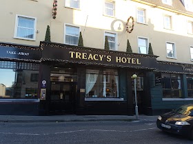
Treacys Hotel, Wexford
Templeshannon, Enniscorthy
Bar
read more
11.831 km
Holohans Pub
The Cotton Tree, 3 Slaney Place, Enniscorthy
Bar
read more
11.843 km
Holohans Bar
Slaney Place, Templeshannon, Enniscorthy
Bar
read more
11.865 km
The Alamo Restaurant
The Alamo Steakhouse, The Promenade, Enniscorthy, Co Wexford, Wexford
Bar
read more
11.957 km
Stamps Pub
20 Market Square, Enniscorthy
Bar
read more
11.97 km
The Pub
Market Square Market Square, Templeshannon, Enniscorthy
Bar
read more
12.182 km
The Thatch
Ferns Upper
Bar
read more
12.282 km
Porters
Y25 W886,, Killenagh
Bar
read more
12.475 km
Porters Bar killenagh
Killenagh Road, Brickpark, Gorey
Bar
read more
12.632 km
Parkside
Main Street, Camolin
Bar
read more
14.008 km
The Porter House
Castlebridge
Bar
read more
14.079 km
Peg's Bar
Ballygarrett Little
Bar
read more
14.765 km
The Strand Bar
Cahore, Ballygarrett,, Gorey
Bar
read more
15.165 km
Foley's
5 Saint Patrick's Terrace, Crossabeg
Bar
read more
15.318 km
Coleman's Pub
Ashfield Ashfield, Tombrack, Ferns
Bar
read more
17.351 km
Parklands Bar & Eatery
Parklands, Ardamine, Courtown,, Gorey
Bar
read more
17.593 km
Andrew's Shed
Silver Winds, 4, Kenny's Borough, Ardamine
Bar
read more
📑
all categories
Accounting
Administrative area level 1
Administrative area level 2
Airport
Amusement park
Aquarium
Art gallery
Atm
Bakery
Bank
Bar
Beauty salon
Bicycle store
Book store
Bowling alley
Bus station
Cafe
Campground
Car dealer
Car rental
Car repair
Car wash
Casino
Cemetery
Church
City hall
Clothing store
Colloquial area
Convenience store
Country
Courthouse
Dentist
Department store
Doctor
Electrician
Electronics store
Embassy
Establishment
Finance
Fire station
Florist
Food
Funeral home
Furniture store
Gas station
General contractor
Grocery or supermarket
Gym
Hair care
Hardware store
Health
Hindu Temple
Home goods store
Hospital
Insurance agency
Jewelry store
Laundry
Lawyer
Library
Light rail station
Liquor store
Local government office
Locality
Locksmith
Lodging
Meal delivery
Meal takeaway
Mosque
Movie rental
Movie theater
Moving company
Museum
Natural feature
Neighborhood
Night club
Painter
Park
Parking
Pet store
Pharmacy
Physiotherapist
Place of worship
Plumber
Point of interest
Police
Political
Post office
Premise
Real estate agency
Restaurant
Roofing contractor
Route
Rv park, camping
School
Shoe store
Shopping mall
Spa
Stadium
Storage
Store
Sublocality
Subpremise
Supermarket
Synagogue
Taxi stand
Train station
Transit station
Travel agency
University
Veterinary care
Zoo
sublocality level 1
↑