Bar nearby The Fowler
Ireland
Bar nearby The Fowler
The Fowler
35, Main St, Gorey, IE Irlanda
contacts phone
:
+353 53 942 0079
Latitude:
52.6757246
, Longitude:
-6.2947951
larger map & directions
read more
nearest Bar
17 m
McGoverns
72 Main Street, Gorey
Bar
read more
33 m
Pegs Bar
Ballinagam, Ballygarrett lower, Gorey
Bar
read more
54 m
Katie Daly's Bar and Restaurant Gorey
78 Main Street, Gorey
Bar
read more
56 m
Katie dalys chuckos bar
78 Main Street, Gorey
Bar
read more
62 m
Frenchs Pub
Main Street, Gorey
Bar
read more
77 m
Bob's Bar & Lounge
25 Main Street, Gorey corporation lands, Gorey
Bar
read more
101 m
Browne's
45 Main Street, Gorey
Bar
read more
110 m
La Rochelle
7 McDermott Street, Gorey
Bar
read more
120 m
Oscars 64
64 Main Street, Gorey
Bar
read more
120 m
Neil Sweeney,s
64 Main Street, Gorey
Bar
read more
130 m
Paddy Blues
North Parade, Gorey corporation lands
Bar
read more
150 m
Breens Bar
Pearse Street, Gorey
Bar
read more
295 m
The Coach House Gastro Bar
1 Esmonde Street, Gorey
Bar
read more
632 m
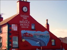
The Bridge Bar
Gorey
Bar
read more
3.005 km
The Bunker Bar
Gorey
Bar
read more
5.59 km
Ambrose Moloneys Public House
19 Harbour Court, Courtown
Bar
read more
5.641 km
Shipyard Inn
Seamount
Bar
read more
5.698 km
Jimmy'z
2 Main Street, Riverchapel
Bar
read more
9.486 km
Porters Bar killenagh
Killenagh Road, Brickpark, Gorey
Bar
read more
11.098 km
Peg's Bar
Ballygarrett Little
Bar
read more
11.467 km
Parkside
Main Street, Camolin
Bar
read more
16.43 km
The Harbour Bar
35 Lower Main Street, Arklow
Bar
read more
16.576 km
The Midway Bar and Lounge
49 Main Street, Arklow
Bar
read more
16.601 km
Smokin Ases
31 Main Street, Arklow
Bar
read more
16.658 km
Hoey's Bridge Hotel
Bridge Street, Arklow
Bar
read more
📑
all categories
Accounting
Administrative area level 1
Administrative area level 2
Airport
Amusement park
Aquarium
Art gallery
Atm
Bakery
Bank
Bar
Beauty salon
Bicycle store
Book store
Bowling alley
Bus station
Cafe
Campground
Car dealer
Car rental
Car repair
Car wash
Casino
Cemetery
Church
City hall
Clothing store
Colloquial area
Convenience store
Country
Courthouse
Dentist
Department store
Doctor
Electrician
Electronics store
Embassy
Establishment
Finance
Fire station
Florist
Food
Funeral home
Furniture store
Gas station
General contractor
Grocery or supermarket
Gym
Hair care
Hardware store
Health
Hindu Temple
Home goods store
Hospital
Insurance agency
Jewelry store
Laundry
Lawyer
Library
Light rail station
Liquor store
Local government office
Locality
Locksmith
Lodging
Meal delivery
Meal takeaway
Mosque
Movie rental
Movie theater
Moving company
Museum
Natural feature
Neighborhood
Night club
Painter
Park
Parking
Pet store
Pharmacy
Physiotherapist
Place of worship
Plumber
Point of interest
Police
Political
Post office
Premise
Real estate agency
Restaurant
Roofing contractor
Route
Rv park, camping
School
Shoe store
Shopping mall
Spa
Stadium
Storage
Store
Sublocality
Subpremise
Supermarket
Synagogue
Taxi stand
Train station
Transit station
Travel agency
University
Veterinary care
Zoo
sublocality level 1
↑