Bar nearby The Holy Grail Pub
Ireland
Bar nearby The Holy Grail Pub
The Holy Grail Pub
9, Rathpark, Y21 FH97, Ballindaggan, IE Ireland
contacts phone
:
+353 53 938 8080
Latitude:
52.5688721
, Longitude:
-6.6813387
larger map & directions
read more
nearest Bar
7.089 km
Ballycarney Inn
Tomgarrow, Ballycarney, Enniscorthy
Bar
read more
9.702 km
Conrans Pub
Rathnure Upper
Bar
read more
9.726 km
Coleman's Pub
Ashfield Ashfield, Tombrack, Ferns
Bar
read more
10.38 km
Donohoes
Duffry Gate, Enniscorthy
Bar
read more
10.657 km
The Pub
Market Square Market Square, Templeshannon, Enniscorthy
Bar
read more
10.657 km
T Doyle The Pub
Market Square Market Square, Templeshannon, Enniscorthy
Bar
read more
10.69 km
Stamps Pub
20 Market Square, Enniscorthy
Bar
read more
10.696 km
Antique Tavern
14 Slaney Street, Enniscorthy
Bar
read more
10.701 km
Toss Kavanaghs
Templeshannon
Bar
read more
10.709 km
Doreen's Bar
19 Slaney Street, Templeshannon, Enniscorthy
Bar
read more
10.71 km
Rackards Bar
23 Rafter Street, Enniscorthy
Bar
read more
10.734 km
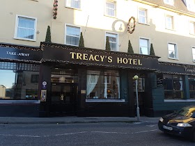
Treacys Hotel, Wexford
Templeshannon, Enniscorthy
Bar
read more
10.745 km
Holohans Bar
Slaney Place, Templeshannon, Enniscorthy
Bar
read more
10.763 km
Holohans Pub
The Cotton Tree, 3 Slaney Place, Enniscorthy
Bar
read more
10.831 km
The Whitehouse
Enniscorthy
Bar
read more
10.926 km
Kehoes on the Quay
Abbey Quay, Enniscorthy
Bar
read more
11.092 km
The Alamo Restaurant
The Alamo Steakhouse, The Promenade, Enniscorthy, Co Wexford, Wexford
Bar
read more
12.505 km
Murphy's Castle Bar
Ferns Upper
Bar
read more
12.511 km
The Thatch
Ferns Upper
Bar
read more
12.518 km
Doyle's
Upper Main Street, Ferns Upper, Ferns
Bar
read more
12.836 km
DUNBARS of Ferns
Main Street, Ferns
Bar
read more
13.179 km
Cloch Ban
Enniscorthy Road, Enniscorthy
Bar
read more
13.484 km
The Cloch Bán
Clonroche
Bar
read more
14.439 km
Monagear Tavern
5 Gleann Na gCaor, Monagear, Ferns
Bar
read more
19.84 km
The Anvil
Ballymurn Upper
Bar
read more
📑
all categories
Accounting
Administrative area level 1
Administrative area level 2
Airport
Amusement park
Aquarium
Art gallery
Atm
Bakery
Bank
Bar
Beauty salon
Bicycle store
Book store
Bowling alley
Bus station
Cafe
Campground
Car dealer
Car rental
Car repair
Car wash
Casino
Cemetery
Church
City hall
Clothing store
Colloquial area
Convenience store
Country
Courthouse
Dentist
Department store
Doctor
Electrician
Electronics store
Embassy
Establishment
Finance
Fire station
Florist
Food
Funeral home
Furniture store
Gas station
General contractor
Grocery or supermarket
Gym
Hair care
Hardware store
Health
Hindu Temple
Home goods store
Hospital
Insurance agency
Jewelry store
Laundry
Lawyer
Library
Light rail station
Liquor store
Local government office
Locality
Locksmith
Lodging
Meal delivery
Meal takeaway
Mosque
Movie rental
Movie theater
Moving company
Museum
Natural feature
Neighborhood
Night club
Painter
Park
Parking
Pet store
Pharmacy
Physiotherapist
Place of worship
Plumber
Point of interest
Police
Political
Post office
Premise
Real estate agency
Restaurant
Roofing contractor
Route
Rv park, camping
School
Shoe store
Shopping mall
Spa
Stadium
Storage
Store
Sublocality
Subpremise
Supermarket
Synagogue
Taxi stand
Train station
Transit station
Travel agency
University
Veterinary care
Zoo
sublocality level 1
↑