Bar nearby The Osborne
Ireland
Bar nearby The Osborne
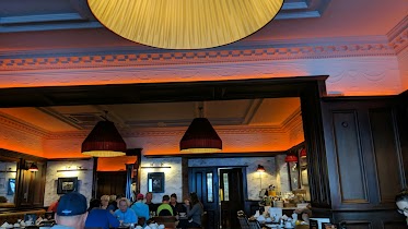
The Osborne
10, Edward Street, V92 PY10, Tralee, IE Ireland
contacts phone
:
+353 66 718 1399
Latitude:
52.269259
, Longitude:
-9.7025008
larger map & directions
read more
nearest Bar
35 m
TURNERS BAR
22 CASTLE ST, Tralee
Bar
read more
40 m
Benners Hotel Tralee
Upper Castle Street, Tralee
Bar
read more
81 m
The Blasket Bar
28 Lower Castle Street, Tralee
Bar
read more
142 m
Castle Street. Tralee.
85 Boherbee, Cloonalour, Tralee
Bar
read more
151 m
The Ballymac Bar
85 Boherbee, Tralee
Bar
read more
159 m
Paddy Mac's Pub
18 The Mall, Tralee
Bar
read more
175 m
The Grand Hotel
Denny Street, Tralee
Bar
read more
238 m
O'Sullivans
29 The Mall, Tralee
Bar
read more
254 m
Roundy's Bar
5 Brogue maker's Lane, Tralee
Bar
read more
293 m
McElligotts Bar
Tralee
Bar
read more
299 m
An Cearnóg bar
7 Dominick Street, Tralee
Bar
read more
301 m
The Square
Dominick Street, Tralee
Bar
read more
341 m
Sportsfield Bar
42 Boherbee, Tralee
Bar
read more
382 m
Sean Ogs Bar & B&B
41 Bridge Street, Tralee
Bar
read more
390 m
An Shebeen
7 Rock Street, Balloonagh, Tralee
Bar
read more
390 m
Rock Inn
11 Rock Street, Tralee
Bar
read more
394 m
Kirbys Brogue Inn
Rock Street, Tralee
Bar
read more
424 m
The Corner House,
V92 X971, 105 Rock Street, Balloonagh, Tralee
Bar
read more
432 m
Joes Place
2 Pembroke Street, Tralee
Bar
read more
457 m
The Castle Bar
77 Rock Street, Tralee
Bar
read more
511 m
ClubHeadBangBang
Pembroke Street, Tralee
Bar
read more
569 m
The Huddle
Strand Street, Tralee
Bar
read more
575 m
Bettys Bar
101 Strand Street, Tralee
Bar
read more
851 m
The Munster Bar
6 Ballymullen Road, Castlemorris Terrace, Tralee
Bar
read more
1.09 km
Meadowlands Hotel
Oakpark, Tralee
Bar
read more
📑
all categories
Accounting
Administrative area level 1
Administrative area level 2
Airport
Amusement park
Aquarium
Art gallery
Atm
Bakery
Bank
Bar
Beauty salon
Bicycle store
Book store
Bowling alley
Bus station
Cafe
Campground
Car dealer
Car rental
Car repair
Car wash
Casino
Cemetery
Church
City hall
Clothing store
Colloquial area
Convenience store
Country
Courthouse
Dentist
Department store
Doctor
Electrician
Electronics store
Embassy
Establishment
Finance
Fire station
Florist
Food
Funeral home
Furniture store
Gas station
General contractor
Grocery or supermarket
Gym
Hair care
Hardware store
Health
Hindu Temple
Home goods store
Hospital
Insurance agency
Jewelry store
Laundry
Lawyer
Library
Light rail station
Liquor store
Local government office
Locality
Locksmith
Lodging
Meal delivery
Meal takeaway
Mosque
Movie rental
Movie theater
Moving company
Museum
Natural feature
Neighborhood
Night club
Painter
Park
Parking
Pet store
Pharmacy
Physiotherapist
Place of worship
Plumber
Point of interest
Police
Political
Post office
Premise
Real estate agency
Restaurant
Roofing contractor
Route
Rv park, camping
School
Shoe store
Shopping mall
Spa
Stadium
Storage
Store
Sublocality
Subpremise
Supermarket
Synagogue
Taxi stand
Train station
Transit station
Travel agency
University
Veterinary care
Zoo
sublocality level 1
↑