Bar nearby The Pub
Ireland
Bar nearby The Pub
The Pub
Dock Road, Limerick, IE Ireland
contacts phone
:
+353
Latitude:
52.6590209
, Longitude:
-8.6380769
larger map & directions
read more
nearest Bar
166 m
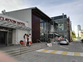
Clayton Hotel Limerick
Steamboat Quay, Limerick
Bar
read more
380 m
South's Pub
4 Quinlan Street, Limerick
Bar
read more
392 m
South's
Limerick
Bar
read more
408 m
Bobby Byrne's
3 O'Connell Avenue, Limerick
Bar
read more
561 m
Tom & Jerry's
3 Lower Glentworth Street, Limerick
Bar
read more
616 m
White House Bar Limerick.
52 O'Connell Street, Limerick
Bar
read more
673 m
Ted's Bar & Venue
102-, O'Connell St O'Connell Street, Limerick
Bar
read more
683 m
The Boardwalk
7 Sráid Na Sionainne, Limerick City, Luimneach
Bar
read more
703 m
The Commercial
46-47 Catherine Street
Bar
read more
738 m
Tom Collins
34 Cecil Street, Limerick
Bar
read more
738 m
Tom Collins Bar
34 Cecil Street, Limerick
Bar
read more
776 m
Jerry Flannery's
20 Catherine Street, Limerick
Bar
read more
794 m
brendan o briens pub
45 Roches Street, Limerick
Bar
read more
883 m
Pharmacia
9 Sarsfield Street, Limerick
Bar
read more
884 m
Murphy's Bar
8 Parnell Street, Limerick
Bar
read more
889 m
Pharmacia
8 Sarsfield Street, Limerick
Bar
read more
896 m
Limerick Strand Hotel
Ennis Road, Limerick
Bar
read more
920 m
Timmy Martins Pub
Liddy Street, Limerick
Bar
read more
979 m
Punch's Pub
Limerick
Bar
read more
1.038 km
Charlie Chaplin's Pub
24 Chapel Street, Limerick
Bar
read more
1.058 km
Clohessy's Bar
Denmark Street, Limerick
Bar
read more
1.076 km
Cobblestone Joes
11 Little Ellen Street, Limerick
Bar
read more
1.079 km
Nancy Blakes
19 Upper Denmark Street, Limerick
Bar
read more
1.086 km
The Old Quarter Gastro Pub
3 Little Ellen Street, Limerick
Bar
read more
1.09 km
Flannerys Bar Limerick
17 Upper Denmark Street, Limerick
Bar
read more
📑
all categories
Accounting
Administrative area level 1
Administrative area level 2
Airport
Amusement park
Aquarium
Art gallery
Atm
Bakery
Bank
Bar
Beauty salon
Bicycle store
Book store
Bowling alley
Bus station
Cafe
Campground
Car dealer
Car rental
Car repair
Car wash
Casino
Cemetery
Church
City hall
Clothing store
Colloquial area
Convenience store
Country
Courthouse
Dentist
Department store
Doctor
Electrician
Electronics store
Embassy
Establishment
Finance
Fire station
Florist
Food
Funeral home
Furniture store
Gas station
General contractor
Grocery or supermarket
Gym
Hair care
Hardware store
Health
Hindu Temple
Home goods store
Hospital
Insurance agency
Jewelry store
Laundry
Lawyer
Library
Light rail station
Liquor store
Local government office
Locality
Locksmith
Lodging
Meal delivery
Meal takeaway
Mosque
Movie rental
Movie theater
Moving company
Museum
Natural feature
Neighborhood
Night club
Painter
Park
Parking
Pet store
Pharmacy
Physiotherapist
Place of worship
Plumber
Point of interest
Police
Political
Post office
Premise
Real estate agency
Restaurant
Roofing contractor
Route
Rv park, camping
School
Shoe store
Shopping mall
Spa
Stadium
Storage
Store
Sublocality
Subpremise
Supermarket
Synagogue
Taxi stand
Train station
Transit station
Travel agency
University
Veterinary care
Zoo
sublocality level 1
↑