Gas station nearby AS24
Ireland
Gas station nearby AS24
AS24
M1 Commons, Whiterath, Dromiskin Irlanda
contacts phone
:
+353
Latitude:
53.9313825
, Longitude:
-6.4168406
read more
nearest Gas station
9 m
AS24
Only Pumps 9. 10. 11. 12 Apple Green Services M1, North Commons, Carlingford
Gas station
read more
804 m
Applegreen
Commons, Dromiskin
Gas station
read more
925 m
Applegreen
M1 - Southbound, Whiterath, Dundalk
Gas station
read more
926 m
Applegreen
M1 - Northbound, Dundalk
Gas station
read more
943 m
AS24
M1 Top Oil, Dundalk
Gas station
read more
1.511 km
Dromiskin Petrol Station
Dromiskin
Gas station
read more
3.935 km
Castlebellingham Petrol Station
Dundalk Road, Castlebellingham
Gas station
read more
3.935 km
Applegreen
Dundalk Road, Dundalk
Gas station
read more
3.936 km
Campus Oil
Dundalk Road, Castlebellingham
Gas station
read more
4.582 km
Flanagnas Service Station
Dublin Road, Dundalk
Gas station
read more
4.582 km
Topaz
Flanagans Motors, Co Louth
Gas station
read more
6.42 km
McNamee
Dundalk
Gas station
read more
6.446 km
Oriel Service Station
Dublin Road, Priorland, Dundalk
Gas station
read more
7.078 km
Brookville Service Station
Ardee Road, Dundalk
Gas station
read more
8.166 km
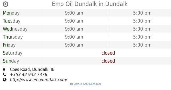
Emo Oil Dundalk
Coes Road, Dundalk
Gas station
read more
9.199 km
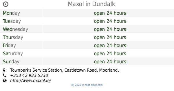
Maxol
Townparks Service Station, Castletown Road, Dundalk
Gas station
read more
9.47 km
Top Oil
Armagh Road, Forkhill Road, Dundalk
Gas station
read more
11.181 km
Carrick Road Service Station
Ardee
Gas station
read more
11.183 km
Texaco Service Station
Carrick Road, Ardee
Gas station
read more
11.21 km
Finlay's Fuel
Cappocksgreen
Gas station
read more
11.788 km
AS24
R173 Ballymac Service Station, Ballymascanian, Dundalk
Gas station
read more
11.791 km
Topaz
R173, Aghaboys
Gas station
read more
11.994 km
Kells Road Service Station
20 Jervis Street, Ardee
Gas station
read more
13.375 km
Inniskeen Fuels
Inishkeen Glebe
Gas station
read more
14.014 km
Top Oil
County Louth
Gas station
read more
📑
all categories
Accounting
Administrative area level 1
Administrative area level 2
Airport
Amusement park
Aquarium
Art gallery
Atm
Bakery
Bank
Bar
Beauty salon
Bicycle store
Book store
Bowling alley
Bus station
Cafe
Campground
Car dealer
Car rental
Car repair
Car wash
Casino
Cemetery
Church
City hall
Clothing store
Colloquial area
Convenience store
Country
Courthouse
Dentist
Department store
Doctor
Electrician
Electronics store
Embassy
Establishment
Finance
Fire station
Florist
Food
Funeral home
Furniture store
Gas station
General contractor
Grocery or supermarket
Gym
Hair care
Hardware store
Health
Hindu Temple
Home goods store
Hospital
Insurance agency
Jewelry store
Laundry
Lawyer
Library
Light rail station
Liquor store
Local government office
Locality
Locksmith
Lodging
Meal delivery
Meal takeaway
Mosque
Movie rental
Movie theater
Moving company
Museum
Natural feature
Neighborhood
Night club
Painter
Park
Parking
Pet store
Pharmacy
Physiotherapist
Place of worship
Plumber
Point of interest
Police
Political
Post office
Premise
Real estate agency
Restaurant
Roofing contractor
Route
Rv park, camping
School
Shoe store
Shopping mall
Spa
Stadium
Storage
Store
Sublocality
Subpremise
Supermarket
Synagogue
Taxi stand
Train station
Transit station
Travel agency
University
Veterinary care
Zoo
sublocality level 1
↑