Locality nearby Delgany
Ireland
Locality nearby Delgany
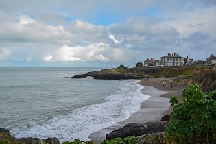
Delgany
Delgany, Co. Wicklow, Ireland
contacts phone
:
+353
Latitude:
53.1326111
, Longitude:
-6.0923308
larger map & directions
read more
nearest Locality
221 m
Wyndham Court
Wyndham Court
Locality
read more
2.029 km
Greystones
Greystones
Locality
read more
2.695 km
Templecarrig
Templecarrig
Locality
read more
3.464 km
Kilcoole
Kilcoole
Locality
read more
4.047 km
Ballycrone Manor
Ballycrone Manor
Locality
read more
7.695 km
Bré
Bré
Locality
read more
8.552 km
Enniskerry
Enniskerry
Locality
read more
8.657 km
Glensynge
Glensynge
Locality
read more
8.911 km
Old Conna
Old Conna
Locality
read more
15.357 km
Rathnew
Rathnew
Locality
read more
15.493 km
Old Village
Old Village
Locality
read more
17.175 km
Wicklow
Wicklow
Locality
read more
23.679 km
Ballsbridge
Ballsbridge
Locality
read more
23.993 km
Rathmines
Rathmines
Locality
read more
26.609 km
Dublin
Dublin
Locality
read more
28.999 km
Clondalkin
Clondalkin
Locality
read more
30.119 km
Tigroney
Tigroney
Locality
read more
35.829 km
Redgap
Redgap
Locality
read more
39.026 km
Naas
Naas
Locality
read more
43.223 km
Maynooth
Maynooth
Locality
read more
45.752 km
Athgarvan Cross
Athgarvan Cross
Locality
read more
45.828 km
Oldtown
Oldtown
Locality
read more
46.025 km
Oldtown Court
Oldtown Court
Locality
read more
47.731 km
Newbridge
Newbridge
Locality
read more
48.33 km
Meath Bridge
Meath Bridge
Locality
read more
📑
all categories
Accounting
Administrative area level 1
Administrative area level 2
Airport
Amusement park
Aquarium
Art gallery
Atm
Bakery
Bank
Bar
Beauty salon
Bicycle store
Book store
Bowling alley
Bus station
Cafe
Campground
Car dealer
Car rental
Car repair
Car wash
Casino
Cemetery
Church
City hall
Clothing store
Colloquial area
Convenience store
Country
Courthouse
Dentist
Department store
Doctor
Electrician
Electronics store
Embassy
Establishment
Finance
Fire station
Florist
Food
Funeral home
Furniture store
Gas station
General contractor
Grocery or supermarket
Gym
Hair care
Hardware store
Health
Hindu Temple
Home goods store
Hospital
Insurance agency
Jewelry store
Laundry
Lawyer
Library
Light rail station
Liquor store
Local government office
Locality
Locksmith
Lodging
Meal delivery
Meal takeaway
Mosque
Movie rental
Movie theater
Moving company
Museum
Natural feature
Neighborhood
Night club
Painter
Park
Parking
Pet store
Pharmacy
Physiotherapist
Place of worship
Plumber
Point of interest
Police
Political
Post office
Premise
Real estate agency
Restaurant
Roofing contractor
Route
Rv park, camping
School
Shoe store
Shopping mall
Spa
Stadium
Storage
Store
Sublocality
Subpremise
Supermarket
Synagogue
Taxi stand
Train station
Transit station
Travel agency
University
Veterinary care
Zoo
sublocality level 1
↑