Locality nearby Enniscorthy
Ireland
Locality nearby Enniscorthy
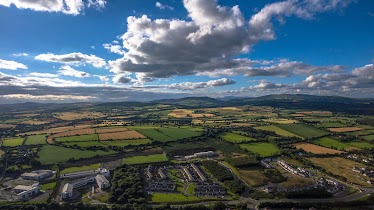
Enniscorthy
Enniscorthy, Co. Wexford, Irlandia
contacts phone
:
+353
Latitude:
52.5031135
, Longitude:
-6.5727721
larger map & directions
read more
nearest Locality
461 m
Railway Square
Railway Square
Locality
read more
9.449 km
Ballymurn
Ballymurn
Locality
read more
10.994 km
Ferns
Ferns
Locality
read more
15.778 km
Castlebridge
Castlebridge
Locality
read more
15.894 km
Ochbeg Lane
Ochbeg Lane
Locality
read more
18.499 km
Crosstown Lane
Crosstown Lane
Locality
read more
18.953 km
Ferrybank
Ferrybank
Locality
read more
22.142 km
Kerlogue
Kerlogue
Locality
read more
23.101 km
Drinagh
Drinagh
Locality
read more
25.191 km
Gorey Business Park
Gorey Business Park
Locality
read more
26.113 km
Ramsgate Village
Ramsgate Village
Locality
read more
26.872 km
Gorey
Gorey
Locality
read more
27.312 km
Riverchapel
Riverchapel
Locality
read more
27.332 km
The Parade
The Parade
Locality
read more
27.448 km
Gorey Bridge
Gorey Bridge
Locality
read more
27.915 km
Maryville Gardens
Maryville Gardens
Locality
read more
28.091 km
Courtown
Courtown
Locality
read more
28.143 km
Clonattin Upper
Clonattin Upper
Locality
read more
28.196 km
Clonattin Lower
Clonattin Lower
Locality
read more
34.624 km
Campile
Campile
Locality
read more
34.836 km
Carrigabruce
Carrigabruce
Locality
read more
41.538 km
Slieverue
Slieverue
Locality
read more
45.434 km
Waterford
Waterford
Locality
read more
46.122 km
Cillín Hill Agri-Business Park
Cillín Hill Agri-Business Park
Locality
read more
47.733 km
Tigroney
Tigroney
Locality
read more
📑
all categories
Accounting
Administrative area level 1
Administrative area level 2
Airport
Amusement park
Aquarium
Art gallery
Atm
Bakery
Bank
Bar
Beauty salon
Bicycle store
Book store
Bowling alley
Bus station
Cafe
Campground
Car dealer
Car rental
Car repair
Car wash
Casino
Cemetery
Church
City hall
Clothing store
Colloquial area
Convenience store
Country
Courthouse
Dentist
Department store
Doctor
Electrician
Electronics store
Embassy
Establishment
Finance
Fire station
Florist
Food
Funeral home
Furniture store
Gas station
General contractor
Grocery or supermarket
Gym
Hair care
Hardware store
Health
Hindu Temple
Home goods store
Hospital
Insurance agency
Jewelry store
Laundry
Lawyer
Library
Light rail station
Liquor store
Local government office
Locality
Locksmith
Lodging
Meal delivery
Meal takeaway
Mosque
Movie rental
Movie theater
Moving company
Museum
Natural feature
Neighborhood
Night club
Painter
Park
Parking
Pet store
Pharmacy
Physiotherapist
Place of worship
Plumber
Point of interest
Police
Political
Post office
Premise
Real estate agency
Restaurant
Roofing contractor
Route
Rv park, camping
School
Shoe store
Shopping mall
Spa
Stadium
Storage
Store
Sublocality
Subpremise
Supermarket
Synagogue
Taxi stand
Train station
Transit station
Travel agency
University
Veterinary care
Zoo
sublocality level 1
↑