Lodging nearby Aisling B&B
Ireland
Lodging nearby Aisling B&B
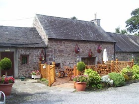
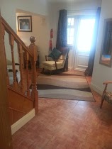
Aisling B&B
R664, Gortaknockeare Ireland
contacts phone
:
+353
Latitude:
52.4528628
, Longitude:
-8.1626351
read more
nearest Lodging
11 m
Aisling B&B
Glen of Aherlow Road
Lodging
read more
1.196 km
Ballyglass Country House
Glen of Aherlow Road, Tipperary
Lodging
read more
2.001 km
Riverside House
Galbally Road, Tipperary
Lodging
read more
2.019 km
Clonmore House
Galbally Road, Tipperary
Lodging
read more
2.274 km
Emmet House Bed and Breakfast
33 Main Street, Tipperary Town
Lodging
read more
2.278 km
Ach na Sheen Guest House
Clonmel Road Clonmel Road, Tipperary
Lodging
read more
2.287 km
Gerry Casey, Central B&B Tipperary
44 Main Street, Tipperary
Lodging
read more
2.318 km
Coolangatta Bed & Breakfast Ballinderry
BrockaBallinderry Nenagh, Tipperary
Lodging
read more
2.376 km
Times Hotel
Bank Place, Tipperary
Lodging
read more
2.493 km
Kilshane House
Tipperary
Lodging
read more
2.928 km
Aherlow Castle
Gortavoher West
Lodging
read more
3.497 km
Springhouse Bed & Breakfast
N24, Kilshane
Lodging
read more
3.695 km
Aherlow House Hotel & Lodges
Glen of, Aherlow
Lodging
read more
3.732 km
Aherlow House Hotel & Lodges Tipperary
Ireland
Lodging
read more
3.732 km
Aherlow House Hotel
Ireland
Lodging
read more
4.168 km
Kilshane House
Ireland
Lodging
read more
4.442 km
Homeleigh Farmhouse
Glen House, Gortavoher West, Tipperary
Lodging
read more
4.886 km
Aherlow Castle
Bansha West
Lodging
read more
6.259 km
Bansha Castle
Bansha
Lodging
read more
6.447 km
Ballykisteen Lodge
Monard
Lodging
read more
7.311 km
The Lodge B&B
Ballyryan East, Monard Lower
Lodging
read more
7.68 km
The Lodge B&B
Monard, Tipperary
Lodging
read more
10.68 km
Thomond House Bed & Breakfast
Thomond House, Galbally
Lodging
read more
14.295 km
New Thatch Farm, knocklong
Knocklong Scarteen, Cross of the Tree
Lodging
read more
16.229 km
Motorwaylodge Kilcoran Cahir
Kilcoran Cahir Co Tipperary, Cahir
Lodging
read more
📑
all categories
Accounting
Administrative area level 1
Administrative area level 2
Airport
Amusement park
Aquarium
Art gallery
Atm
Bakery
Bank
Bar
Beauty salon
Bicycle store
Book store
Bowling alley
Bus station
Cafe
Campground
Car dealer
Car rental
Car repair
Car wash
Casino
Cemetery
Church
City hall
Clothing store
Colloquial area
Convenience store
Country
Courthouse
Dentist
Department store
Doctor
Electrician
Electronics store
Embassy
Establishment
Finance
Fire station
Florist
Food
Funeral home
Furniture store
Gas station
General contractor
Grocery or supermarket
Gym
Hair care
Hardware store
Health
Hindu Temple
Home goods store
Hospital
Insurance agency
Jewelry store
Laundry
Lawyer
Library
Light rail station
Liquor store
Local government office
Locality
Locksmith
Lodging
Meal delivery
Meal takeaway
Mosque
Movie rental
Movie theater
Moving company
Museum
Natural feature
Neighborhood
Night club
Painter
Park
Parking
Pet store
Pharmacy
Physiotherapist
Place of worship
Plumber
Point of interest
Police
Political
Post office
Premise
Real estate agency
Restaurant
Roofing contractor
Route
Rv park, camping
School
Shoe store
Shopping mall
Spa
Stadium
Storage
Store
Sublocality
Subpremise
Supermarket
Synagogue
Taxi stand
Train station
Transit station
Travel agency
University
Veterinary care
Zoo
sublocality level 1
↑