Lodging nearby Ferrycarrig Lodge B&B
Ireland
Lodging nearby Ferrycarrig Lodge B&B
Ferrycarrig Lodge B&B
32, Westgate Park, Y35 W2V6, Wexford, IE Irland
contacts phone
:
+353 53 914 2605
website:
www.ferrycarriglodge.ie
Latitude:
52.3498454
, Longitude:
-6.5045094
larger map & directions
read more
nearest Lodging
489 m
Ferrycarrig Hotel
Ferrycarrig Hotel, Ferrycarrig, Wexford
Lodging
read more
851 m
Ferrycarrig Hotel
Ferrycarrig
Lodging
read more
1.181 km
The Gallops
Newtown Road, Wexford
Lodging
read more
1.289 km
The Gallops B+B
Bettyville, Newtown Road, Wexford
Lodging
read more
2.069 km
Slaney Manor
Slaney Manor, Barntown, Wexford
Lodging
read more
2.112 km
GLEN HILL B&B
Barntown
Lodging
read more
2.188 km
Granville House and Gardens Bed and Breakfast
Clonard Road, Wexford
Lodging
read more
2.428 km
Rosemount House B&B
Spawell Road, Wexford
Lodging
read more
2.713 km
MJs Beginning
Saint John's Road, Wexford
Lodging
read more
2.765 km
Cuasnog Bed & Breakfast
Saint John's Road, Wexford
Lodging
read more
2.765 km
CUASNÓG
Saint John's Road, Wexford
Lodging
read more
2.803 km
bed and breakfast in wexford the wexford arms
96 Upper John Street, Wexford
Lodging
read more
2.822 km
St George Guesthouse Wexford
Upper george's Street, Wexford
Lodging
read more
2.892 km
The Blue Door
18 Lower george's Street, Wexford
Lodging
read more
2.904 km
Abbey House Bed & Breakfast
34/36 Abbey Street, Wexford
Lodging
read more
2.925 km
Central Wexford Apartment
Hollyville Court, Francis Street 12, Wexford
Lodging
read more
2.954 km
Clayton Whites Hotel
Abbey Street, Wexford
Lodging
read more
3.066 km
Wexford Town Apartment
North Main Street Wexford, Wexford
Lodging
read more
3.196 km
Wexford Town Centre Apartment
Key West, Church Lane, Wexford
Lodging
read more
3.42 km
Riverbank House Hotel
Ferrybank South, Wexford
Lodging
read more
3.703 km
Faythe Guesthouse
6A Swan View, Wexford
Lodging
read more
3.811 km
Respond Group Home
Wexford
Lodging
read more
4.88 km
Maple Lodge
Castlebridge
Lodging
read more
5.678 km
Birchwood House
90 Árd Áilinn, Castlebridge
Lodging
read more
5.7 km
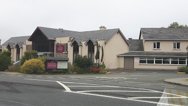
Farmers Kitchen Hotel
Rosslare Road
Lodging
read more
📑
all categories
Accounting
Administrative area level 1
Administrative area level 2
Airport
Amusement park
Aquarium
Art gallery
Atm
Bakery
Bank
Bar
Beauty salon
Bicycle store
Book store
Bowling alley
Bus station
Cafe
Campground
Car dealer
Car rental
Car repair
Car wash
Casino
Cemetery
Church
City hall
Clothing store
Colloquial area
Convenience store
Country
Courthouse
Dentist
Department store
Doctor
Electrician
Electronics store
Embassy
Establishment
Finance
Fire station
Florist
Food
Funeral home
Furniture store
Gas station
General contractor
Grocery or supermarket
Gym
Hair care
Hardware store
Health
Hindu Temple
Home goods store
Hospital
Insurance agency
Jewelry store
Laundry
Lawyer
Library
Light rail station
Liquor store
Local government office
Locality
Locksmith
Lodging
Meal delivery
Meal takeaway
Mosque
Movie rental
Movie theater
Moving company
Museum
Natural feature
Neighborhood
Night club
Painter
Park
Parking
Pet store
Pharmacy
Physiotherapist
Place of worship
Plumber
Point of interest
Police
Political
Post office
Premise
Real estate agency
Restaurant
Roofing contractor
Route
Rv park, camping
School
Shoe store
Shopping mall
Spa
Stadium
Storage
Store
Sublocality
Subpremise
Supermarket
Synagogue
Taxi stand
Train station
Transit station
Travel agency
University
Veterinary care
Zoo
sublocality level 1
↑