Lodging nearby Lou's Place
Ireland
Lodging nearby Lou's Place
Lou's Place
176 Acha Bhile, Lahinch Road, Ennis Ireland
contacts phone
:
+353
Latitude:
52.8587411
, Longitude:
-9.0120637
read more
nearest Lodging
639 m
Oakley House B&B
10 Woodlawn, Loughvella, Ennis
Lodging
read more
1.214 km
Ardan House
3 Dromard, Ennis
Lodging
read more
1.34 km
2 Bed Bungalow in Ennis
Lahinch Road 2, Brookville, Ennis
Lodging
read more
1.778 km
Roisin B&B
34 Pine Grove, Ennis
Lodging
read more
1.804 km
5 Glensheen
5 Glensheen, Ennis
Lodging
read more
1.805 km
Virtual Bed and Breakfast Ireland
14 Elm Park, Ennis
Lodging
read more
1.944 km
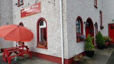
Westbrook House Guest Accommodation
Galway Road, Ennis
Lodging
read more
1.979 km
Hillview Farmhouse B&B
Maghera, Tulla, Ennis
Lodging
read more
2.133 km
Ashford Court Hotel
1 Old Mill Road, Ennis
Lodging
read more
2.175 km
Hotel Woodstock, an Ascend Hotel Collection Member
Shanaway Road, Clare
Lodging
read more
2.222 km
Auburn Lodge Hotel
Gort Road, Ennis
Lodging
read more
2.257 km
Hotel Woodstock
Shanaway Road, Ennis
Lodging
read more
2.426 km
Rowan Tree Hostel
Harmony Row, Ennis
Lodging
read more
2.469 km
Knocklyon House B&B
Showgrounds Road, Ennis
Lodging
read more
2.506 km
Quite Town House
11 Corrovorrin Drive, Ennis
Lodging
read more
2.578 km
Banner Lodge
Market Place, Ennis
Lodging
read more
2.578 km
Banner Lodge Guest House
Market Place, Ennis
Lodging
read more
2.578 km
Banner Lodge Guest House Hotel
Market Place, Ennis
Lodging
read more
2.615 km
Clare Youth Service
Carmody Street, Ennis
Lodging
read more
2.664 km
Old Ground Hotel
O'Connell Street, Ennis
Lodging
read more
2.664 km
Old Ground Hotel Ennis
O'Connell Street, Ennis
Lodging
read more
2.766 km
Railway View House B&B
Tulla Road, Ennis
Lodging
read more
2.956 km
Klondell Holiday Home
Banff, 2 Liscannor Road, Lahinch
Lodging
read more
2.961 km
Town House
4 Station Road, Ennis
Lodging
read more
2.998 km
Stonehaven B&B
Kilrush Road, Ennis
Lodging
read more
📑
all categories
Accounting
Administrative area level 1
Administrative area level 2
Airport
Amusement park
Aquarium
Art gallery
Atm
Bakery
Bank
Bar
Beauty salon
Bicycle store
Book store
Bowling alley
Bus station
Cafe
Campground
Car dealer
Car rental
Car repair
Car wash
Casino
Cemetery
Church
City hall
Clothing store
Colloquial area
Convenience store
Country
Courthouse
Dentist
Department store
Doctor
Electrician
Electronics store
Embassy
Establishment
Finance
Fire station
Florist
Food
Funeral home
Furniture store
Gas station
General contractor
Grocery or supermarket
Gym
Hair care
Hardware store
Health
Hindu Temple
Home goods store
Hospital
Insurance agency
Jewelry store
Laundry
Lawyer
Library
Light rail station
Liquor store
Local government office
Locality
Locksmith
Lodging
Meal delivery
Meal takeaway
Mosque
Movie rental
Movie theater
Moving company
Museum
Natural feature
Neighborhood
Night club
Painter
Park
Parking
Pet store
Pharmacy
Physiotherapist
Place of worship
Plumber
Point of interest
Police
Political
Post office
Premise
Real estate agency
Restaurant
Roofing contractor
Route
Rv park, camping
School
Shoe store
Shopping mall
Spa
Stadium
Storage
Store
Sublocality
Subpremise
Supermarket
Synagogue
Taxi stand
Train station
Transit station
Travel agency
University
Veterinary care
Zoo
sublocality level 1
↑