Lodging nearby Nephin Lodge B&B
Ireland
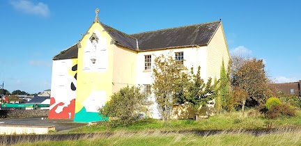
Lodging nearby Nephin Lodge B&B
Nephin Lodge B&B
Leenane Road, Westport Ireland
contacts phone
:
+353
Latitude:
53.790485
, Longitude:
-9.530082
read more
nearest Lodging
363 m
Lurgan House Bed & Breakfast
Lurgan House, Carrownalurgan, Mayo
Lodging
read more
564 m
Carrabawn Opposite Emo
Leenane Road, Westport
Lodging
read more
775 m
Mcbrides Terrace Town House
6 Mac Brides Terrace, Westport
Lodging
read more
795 m
Hilltop
1-3 Tober Hill, Cahernamart, Westport
Lodging
read more
805 m
Cloonmonad House
Quay Road, Westport
Lodging
read more
814 m
Drummin House
Tober Hill, Westport
Lodging
read more
861 m
Carrabaun House
Leenane Road, Westport
Lodging
read more
882 m
The Westport Bit
26 Peter Street, Westport
Lodging
read more
934 m
Westport Holiday Home
11 High Street, Westport
Lodging
read more
973 m
McCarthys Guest House
Quay Street, Westport
Lodging
read more
973 m
McCarthys Guesthouse B&B
Quay Street, Westport
Lodging
read more
996 m
Adare House Westport
Quay Road, Westport
Lodging
read more
996 m
Adare House Westport Hotel
Quay Road, Westport
Lodging
read more
998 m
Adare House Bed & Breakfast
Quay Road, Westport
Lodging
read more
1.019 km
Quay Lodge B&B
Cloonmonad
Lodging
read more
1.032 km
The Wyatt Hotel
The Octagon, Westport
Lodging
read more
1.039 km
Westport Hotels In1
10 Octagon, Westport
Lodging
read more
1.041 km
Broadlands Bed & Breakfast
Quay Road, Westport
Lodging
read more
1.044 km
Mill Times Hotel Westport
Mill Street, Westport
Lodging
read more
1.106 km
Hazelbreeze B&B
15 Springfield Drive, Westport
Lodging
read more
1.121 km
Quay West Accommodation, Westport, Ireland
Quay Road, Westport
Lodging
read more
1.244 km
Boffin Lodge
The Quay, Westport
Lodging
read more
1.244 km
Grove Cottage
Boffin Street, The Quay, Westport
Lodging
read more
1.264 km
Linden Hall
Altamount Street, Westport
Lodging
read more
1.317 km
Altamont House
Altamount Street, Westport
Lodging
read more
📑
all categories
Accounting
Administrative area level 1
Administrative area level 2
Airport
Amusement park
Aquarium
Art gallery
Atm
Bakery
Bank
Bar
Beauty salon
Bicycle store
Book store
Bowling alley
Bus station
Cafe
Campground
Car dealer
Car rental
Car repair
Car wash
Casino
Cemetery
Church
City hall
Clothing store
Colloquial area
Convenience store
Country
Courthouse
Dentist
Department store
Doctor
Electrician
Electronics store
Embassy
Establishment
Finance
Fire station
Florist
Food
Funeral home
Furniture store
Gas station
General contractor
Grocery or supermarket
Gym
Hair care
Hardware store
Health
Hindu Temple
Home goods store
Hospital
Insurance agency
Jewelry store
Laundry
Lawyer
Library
Light rail station
Liquor store
Local government office
Locality
Locksmith
Lodging
Meal delivery
Meal takeaway
Mosque
Movie rental
Movie theater
Moving company
Museum
Natural feature
Neighborhood
Night club
Painter
Park
Parking
Pet store
Pharmacy
Physiotherapist
Place of worship
Plumber
Point of interest
Police
Political
Post office
Premise
Real estate agency
Restaurant
Roofing contractor
Route
Rv park, camping
School
Shoe store
Shopping mall
Spa
Stadium
Storage
Store
Sublocality
Subpremise
Supermarket
Synagogue
Taxi stand
Train station
Transit station
Travel agency
University
Veterinary care
Zoo
sublocality level 1
↑