Lodging nearby Perrymount Country Home
Ireland
Lodging nearby Perrymount Country Home
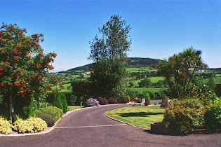
Perrymount Country Home
Perrymount, Gorey, Co. Wexford, Irlanda
contacts phone
:
+353 402 37418
website:
perrymountcountryhome.com
Latitude:
52.738722
, Longitude:
-6.2409478
larger map & directions
read more
nearest Lodging
299 m
Riverfield Farmhouse B&B Accommodation
Inch, Gorey
Lodging
read more
2.233 km
Hyde Park
Unnamed Road, Hydepark, Co., Wexford
Lodging
read more
2.73 km
Woodlands Country House
Ballynestragh, Gorey
Lodging
read more
2.73 km
Woodlands Country House
Jaytree, 8 Woodlands, Courtown
Lodging
read more
2.766 km
Bay View Hotel & Leisure Centre
Main Street, Killybegs
Lodging
read more
2.766 km
Tara Hotel
Main Street, Killybegs
Lodging
read more
2.796 km
Daru House B & B
Ballywilliam ,Gorey
Lodging
read more
3.272 km
Tara Haven
Ballywilliam
Lodging
read more
4.003 km
Hillside House Bed & Breakfast
Tuberduff, Gorey
Lodging
read more
4.431 km
Seafield Hotel
Castletown
Lodging
read more
5.238 km
Tara Hill Lodge
Tara Hill House, Tara Hill, Gorey
Lodging
read more
5.874 km
Rose Cottage
Croghan House Croghan, Gorey
Lodging
read more
5.899 km
Kilpatrick Beach
Castletown
Lodging
read more
5.968 km
Samir
Arklow, Thomastown
Lodging
read more
7.149 km
Ballymoney Beach
Ballymoney
Lodging
read more
7.422 km
The Ould Town
Clonroe Upper
Lodging
read more
7.888 km
Valentia Lodge Accomodation
Coolgreany Road, Arklow
Lodging
read more
10.403 km
Woodenbridge Hotel & Lodge
Woodenbridge, Arklow
Lodging
read more
10.42 km
The Taravie Hotel
Harbour Court, Seamount, Courtown
Lodging
read more
10.496 km
Harbour House B&B and Guest House
19 Harbour Court, Courtown
Lodging
read more
11.407 km
Stonelodge Bed and Breakfast
Ardamine Court, Courtown
Lodging
read more
11.68 km
Clone House Event Villa
Clone House, Clone, Aughrim
Lodging
read more
12.122 km
Barnadown B&B
Clogh, Gorey
Lodging
read more
14.876 km
Countrywide Hotels Ireland Limited
Ballycanew
Lodging
read more
18.731 km
Askanagap
Preban, Tinahely
Lodging
read more
📑
all categories
Accounting
Administrative area level 1
Administrative area level 2
Airport
Amusement park
Aquarium
Art gallery
Atm
Bakery
Bank
Bar
Beauty salon
Bicycle store
Book store
Bowling alley
Bus station
Cafe
Campground
Car dealer
Car rental
Car repair
Car wash
Casino
Cemetery
Church
City hall
Clothing store
Colloquial area
Convenience store
Country
Courthouse
Dentist
Department store
Doctor
Electrician
Electronics store
Embassy
Establishment
Finance
Fire station
Florist
Food
Funeral home
Furniture store
Gas station
General contractor
Grocery or supermarket
Gym
Hair care
Hardware store
Health
Hindu Temple
Home goods store
Hospital
Insurance agency
Jewelry store
Laundry
Lawyer
Library
Light rail station
Liquor store
Local government office
Locality
Locksmith
Lodging
Meal delivery
Meal takeaway
Mosque
Movie rental
Movie theater
Moving company
Museum
Natural feature
Neighborhood
Night club
Painter
Park
Parking
Pet store
Pharmacy
Physiotherapist
Place of worship
Plumber
Point of interest
Police
Political
Post office
Premise
Real estate agency
Restaurant
Roofing contractor
Route
Rv park, camping
School
Shoe store
Shopping mall
Spa
Stadium
Storage
Store
Sublocality
Subpremise
Supermarket
Synagogue
Taxi stand
Train station
Transit station
Travel agency
University
Veterinary care
Zoo
sublocality level 1
↑