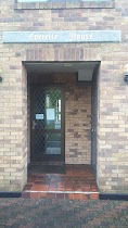
Lodging nearby Social Eire
Ireland
Lodging nearby Social Eire
Social Eire
Chantiere Gate, Portlaoise, IE Irlandia
contacts phone
:
+353 83 199 6129
Latitude:
53.0356902
, Longitude:
-7.2742661
larger map & directions
read more
nearest Lodging
429 m
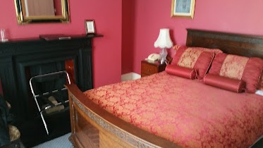
Laois Country Lodge
Dublin Road, Portlaoise
Lodging
read more
679 m
Richy Lodge B&B
summerhill lane 152 Ashewood Walk, Portlaoise
Lodging
read more
1.369 km
walsh windscreens
Ballymackan
Lodging
read more
1.615 km
O'Loughlins Hotel
30 Main Street, Portlaoise
Lodging
read more
1.671 km
Midlands park hotel
Portlaoise
Lodging
read more
1.709 km
Ivyleigh House
Bank Place, Portlaoise
Lodging
read more
1.72 km
Ivyleigh House
Bank Place, Portlaois
Lodging
read more
1.924 km
Maher's B&B
Beech Avenue, Rathleague, Portlaoise
Lodging
read more
2.938 km
Maldron Hotel Portlaoise
Abbeyleix Road, Portlaoise
Lodging
read more
6.021 km
La Virginia Inn
laois
Lodging
read more
7.111 km
The Old Rectory Coach-houses
8 Lyster Square, Portlaoise
Lodging
read more
9.547 km
The Spires Stadbally Self Catering
Brockley Park House, Rathaniska, Stradbally
Lodging
read more
10.043 km
Martinville Self Catering
Borness Road, Strahard, Mountmellick
Lodging
read more
10.777 km
Emo Park House
Unnamed Road, Lough
Lodging
read more
13.007 km
Barrow View B&B
Upper Forest, Mountmellick
Lodging
read more
13.628 km
Sawgrass Guesthouse
Sawgrass, 3 Tirhogar Drive, Portarlington
Lodging
read more
13.636 km
Ryan's Guest House
Townhouse 9, the First Fairway, Heritage Hotel and Golf Resort, Killenard
Lodging
read more
13.716 km
Rathmiles Ave. Killenard - Large Double Bedroom
The Heritage 11 Rathmiles Avenue, Portarlington
Lodging
read more
14.409 km
Bed and Breakfast Laois
Ballinakill Road, Abbeyliex
Lodging
read more
15.297 km
Abbeyleix Manor Hotel
Cork Road, Abbeyleix
Lodging
read more
15.818 km
Sandymount House B&B Hotel
Ireland
Lodging
read more
15.818 km
Sandymount House B&B
Ireland
Lodging
read more
17.603 km
اوتيل هازل
مقاطعة كيلدير، Co
Lodging
read more
19.233 km
Traditional Farm Hostel
Farran House
Lodging
read more
19.257 km
Robins Rest
Old Grange Avenue, Monasterevin
Lodging
read more
📑
all categories
Accounting
Administrative area level 1
Administrative area level 2
Airport
Amusement park
Aquarium
Art gallery
Atm
Bakery
Bank
Bar
Beauty salon
Bicycle store
Book store
Bowling alley
Bus station
Cafe
Campground
Car dealer
Car rental
Car repair
Car wash
Casino
Cemetery
Church
City hall
Clothing store
Colloquial area
Convenience store
Country
Courthouse
Dentist
Department store
Doctor
Electrician
Electronics store
Embassy
Establishment
Finance
Fire station
Florist
Food
Funeral home
Furniture store
Gas station
General contractor
Grocery or supermarket
Gym
Hair care
Hardware store
Health
Hindu Temple
Home goods store
Hospital
Insurance agency
Jewelry store
Laundry
Lawyer
Library
Light rail station
Liquor store
Local government office
Locality
Locksmith
Lodging
Meal delivery
Meal takeaway
Mosque
Movie rental
Movie theater
Moving company
Museum
Natural feature
Neighborhood
Night club
Painter
Park
Parking
Pet store
Pharmacy
Physiotherapist
Place of worship
Plumber
Point of interest
Police
Political
Post office
Premise
Real estate agency
Restaurant
Roofing contractor
Route
Rv park, camping
School
Shoe store
Shopping mall
Spa
Stadium
Storage
Store
Sublocality
Subpremise
Supermarket
Synagogue
Taxi stand
Train station
Transit station
Travel agency
University
Veterinary care
Zoo
sublocality level 1
↑