Lodging nearby The Wishing Well Accommodation
Ireland
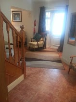
Lodging nearby The Wishing Well Accommodation
The Wishing Well Accommodation
Upper Cahir Abbey, Tipperary Road, Cahir Irland
contacts phone
:
+353
Latitude:
52.38578
, Longitude:
-7.9337817
read more
nearest Lodging
1.009 km
Hogan's Square
5-7 Hogan's Square, Townparks, Cahir
Lodging
read more
1.071 km
Cahir Abbey Upper
Mountain Road, Tipperary
Lodging
read more
1.081 km
Carrigeen Castle
Mitchelstown Road, Cahir
Lodging
read more
1.355 km
Tinsley House BED & BREAKFAST
The Square, Cahir
Lodging
read more
1.41 km
Hollymount House
Upper Cahir Abbey, Cahir
Lodging
read more
1.566 km
Ard na Greine B&B
Clonmel Road, Cahir
Lodging
read more
1.845 km
Castle Gardens Bed and Breakfast
ardfinnan road, cahir
Lodging
read more
3.94 km
Seven Oaks Hotel
Tipperary Road
Lodging
read more
4.61 km
Carrigeen Castle
Carrigeen, Cahir
Lodging
read more
5.072 km
Annaswood B&B
Scartana House, Scartana, Cahir
Lodging
read more
5.797 km
Kilcoran Lodge Hotel
Cahir
Lodging
read more
6.366 km
Motorwaylodge Kilcoran Cahir
Kilcoran Cahir Co Tipperary, Cahir
Lodging
read more
8.592 km
Mrs Delaney's Loft, Clonmel
Pulamrom L
Lodging
read more
11.682 km
Bansha Castle
Bansha
Lodging
read more
12.527 km
Aherlow Castle
Bansha West
Lodging
read more
13.718 km
Kilshane House
Ireland
Lodging
read more
13.998 km
Mrs G Egan
31 Wheatfields, Ballingranne, Clonmel
Lodging
read more
14.379 km
Springhouse Bed & Breakfast
N24, Kilshane
Lodging
read more
14.59 km
Copperfield House B&B
Boherclogh Street, Cashel
Lodging
read more
14.817 km
Cashel Town B&B
5 John Street, Cashel
Lodging
read more
15.161 km
O'Briens Holiday Lodge and Camping park
Rock House, Mountjudkin, Cashel
Lodging
read more
15.517 km
Palm Grove B&B
Cashel
Lodging
read more
17.021 km
Glasha Farmhouse
Ballymacarbry, Clonmel
Lodging
read more
17.932 km
Kilshane House
Tipperary
Lodging
read more
18.535 km
Mobarnane House Bed and Breakfast
Fethard
Lodging
read more
📑
all categories
Accounting
Administrative area level 1
Administrative area level 2
Airport
Amusement park
Aquarium
Art gallery
Atm
Bakery
Bank
Bar
Beauty salon
Bicycle store
Book store
Bowling alley
Bus station
Cafe
Campground
Car dealer
Car rental
Car repair
Car wash
Casino
Cemetery
Church
City hall
Clothing store
Colloquial area
Convenience store
Country
Courthouse
Dentist
Department store
Doctor
Electrician
Electronics store
Embassy
Establishment
Finance
Fire station
Florist
Food
Funeral home
Furniture store
Gas station
General contractor
Grocery or supermarket
Gym
Hair care
Hardware store
Health
Hindu Temple
Home goods store
Hospital
Insurance agency
Jewelry store
Laundry
Lawyer
Library
Light rail station
Liquor store
Local government office
Locality
Locksmith
Lodging
Meal delivery
Meal takeaway
Mosque
Movie rental
Movie theater
Moving company
Museum
Natural feature
Neighborhood
Night club
Painter
Park
Parking
Pet store
Pharmacy
Physiotherapist
Place of worship
Plumber
Point of interest
Police
Political
Post office
Premise
Real estate agency
Restaurant
Roofing contractor
Route
Rv park, camping
School
Shoe store
Shopping mall
Spa
Stadium
Storage
Store
Sublocality
Subpremise
Supermarket
Synagogue
Taxi stand
Train station
Transit station
Travel agency
University
Veterinary care
Zoo
sublocality level 1
↑