School nearby Ballyfad National School
Ireland
School nearby Ballyfad National School
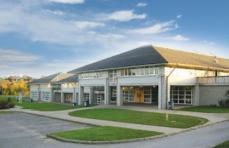
Ballyfad National School
Pallas Lower Irlanda
contacts phone
:
+353
Latitude:
52.7669415
, Longitude:
-6.2696327
read more
nearest School
28 m
Ballyfad National School
Ballyfad, Gorey
School
read more
403 m
Oulart National School
Oulart, Gorey
School
read more
3.957 km
Ballyflanigan Montessori
Thomastown House, Thomastown, Arklow
School
read more
6.91 km
Jellybeans Playschool
60 Knockmore, Arklow
School
read more
7.249 km
Glenart College
Coolgreaney Road, Arklow
School
read more
7.546 km
Carysfort Mixed National School
Yellow Lane, Arklow
School
read more
7.764 km
ST johns senior natinol school
10 Coolgreaney Road, Arklow
School
read more
8.103 km
St Michael and Peter's Junior School
Saint Mary's Road, Abbeylands, Arklow
School
read more
8.144 km
Blackberry Acadamey
1-, 11 Saint Mary's Road, Arklow
School
read more
8.203 km
Saint Mary's Girls National School
54 Connolly Street, Arklow
School
read more
8.389 km
Scoil Naomh Padraig
Bearna Chle, Arklow
School
read more
8.811 km
Helena Brennan Porcelain
Unnamed Road
School
read more
9.134 km
Arklow Montessori School
Inbhear Mór Square, 11, Arklow
School
read more
10.282 km
St Joseph Primary School
Creagh, Gorey
School
read more
10.291 km
Small Wonders Creche & Pre School
Courtown Road, Gorey
School
read more
10.365 km
Avoca National School
Avoca
School
read more
10.495 km
Gorey Community School
Esmonde Street, Gorey
School
read more
10.643 km
Monaseed National School
Monaseed, Gorey
School
read more
10.69 km
Gorey Educate Together National School
Kilnahue Lane, Wexford
School
read more
10.779 km
Little Lambs Montessori & Creche
49 Ardmore, Gorey
School
read more
11.04 km
Higgys House Creche & Montessori
The Chase, Gorey
School
read more
11.509 km
gorey guns Club
Ramstown Lower
School
read more
14.767 km
Ballyellis National School
Castlewhite
School
read more
15.542 km
Spruce Lodge
Ballyrogan Upper
School
read more
20.991 km
Cole Potterspoint
Ballynacarrig
School
read more
📑
all categories
Accounting
Administrative area level 1
Administrative area level 2
Airport
Amusement park
Aquarium
Art gallery
Atm
Bakery
Bank
Bar
Beauty salon
Bicycle store
Book store
Bowling alley
Bus station
Cafe
Campground
Car dealer
Car rental
Car repair
Car wash
Casino
Cemetery
Church
City hall
Clothing store
Colloquial area
Convenience store
Country
Courthouse
Dentist
Department store
Doctor
Electrician
Electronics store
Embassy
Establishment
Finance
Fire station
Florist
Food
Funeral home
Furniture store
Gas station
General contractor
Grocery or supermarket
Gym
Hair care
Hardware store
Health
Hindu Temple
Home goods store
Hospital
Insurance agency
Jewelry store
Laundry
Lawyer
Library
Light rail station
Liquor store
Local government office
Locality
Locksmith
Lodging
Meal delivery
Meal takeaway
Mosque
Movie rental
Movie theater
Moving company
Museum
Natural feature
Neighborhood
Night club
Painter
Park
Parking
Pet store
Pharmacy
Physiotherapist
Place of worship
Plumber
Point of interest
Police
Political
Post office
Premise
Real estate agency
Restaurant
Roofing contractor
Route
Rv park, camping
School
Shoe store
Shopping mall
Spa
Stadium
Storage
Store
Sublocality
Subpremise
Supermarket
Synagogue
Taxi stand
Train station
Transit station
Travel agency
University
Veterinary care
Zoo
sublocality level 1
↑