School nearby Monastery National School, Ardee
Ireland
School nearby Monastery National School, Ardee
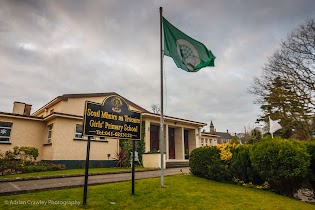
Monastery National School, Ardee
Drogheda Road, Ardee Ireland
contacts phone
:
+353
Latitude:
53.8521279
, Longitude:
-6.53767
read more
nearest School
231 m
Scoil Mhuire Na Trocaire
Hale Street, Ardee
School
read more
408 m
Ardee communitee parish centre
40 The Village, Dawsonsdemesne, Ardee
School
read more
548 m
Pre-school & toddlerplaygroup Little Steps
55 Cherrybrook, Ardee
School
read more
564 m
Ardee Community School
Ardee
School
read more
597 m
Ardee School of Music
Market St Market Street, Cappocksgreen, Ardee
School
read more
1.12 km
Sasta
10, Carrick Rd Carrick Road, Cappocksgreen, Ardee
School
read more
1.189 km
Ardee Youthreach
Mullameelan
School
read more
1.226 km
Ardee Educate Together National School
Dundalk Road, Ardee
School
read more
1.343 km
Kidz Cottage Montessori & After School Club
Yellow house, 2 Carrick Road, Ardee
School
read more
3.654 km
Ballapousta National School
Smarmore, Ballapousta
School
read more
4.322 km
Ballapousta Preschool
9 Market Street, Ardee
School
read more
4.322 km
Ballapousta Preschool
Drakestown, Ardee
School
read more
5.921 km
Newtown National School
Newtown
School
read more
9.337 km
Little & Big Rascals
Ardee Road, Dunleer
School
read more
9.541 km
Dunleer Montessori Tír na nÓg
Drumcar Road, Dunleer
School
read more
11.282 km
Blue Dolphin Powerboat School
Cullens Road, Walterstown, Castlebellingham
School
read more
15.405 km
St Furseys National Pre School
Marlbog Road, Dundalk
School
read more
16.685 km
Blackrock National School
Saint Oliver Plunkett National School, Sandy Lane, Blackrock
School
read more
17.916 km
St.josephs BNS
1 Saint Macartan's Terrace, Carrickmacross
School
read more
18.144 km
Paddy Power
28 Main Street, Carrickmacross, Co Monaghan, Carrickmacross
School
read more
18.263 km
Scoil Rois, Irish Primary School
116 Cloughvalley, Cloghvally Upper, Carrickmacross
School
read more
18.71 km
Inver College
Cloghvalley Upper, Carrickmacross
School
read more
18.809 km
The Playhouse Crèche
83 Windmill Road, Drogheda
School
read more
18.973 km
St Brigid's Girls National School
60 Bóthar Brugha, Drogheda
School
read more
19.17 km
Paddy Power
Unit A, Boyne Shopping Centre, Drogheda, Co Louth, Drogheda
School
read more
📑
all categories
Accounting
Administrative area level 1
Administrative area level 2
Airport
Amusement park
Aquarium
Art gallery
Atm
Bakery
Bank
Bar
Beauty salon
Bicycle store
Book store
Bowling alley
Bus station
Cafe
Campground
Car dealer
Car rental
Car repair
Car wash
Casino
Cemetery
Church
City hall
Clothing store
Colloquial area
Convenience store
Country
Courthouse
Dentist
Department store
Doctor
Electrician
Electronics store
Embassy
Establishment
Finance
Fire station
Florist
Food
Funeral home
Furniture store
Gas station
General contractor
Grocery or supermarket
Gym
Hair care
Hardware store
Health
Hindu Temple
Home goods store
Hospital
Insurance agency
Jewelry store
Laundry
Lawyer
Library
Light rail station
Liquor store
Local government office
Locality
Locksmith
Lodging
Meal delivery
Meal takeaway
Mosque
Movie rental
Movie theater
Moving company
Museum
Natural feature
Neighborhood
Night club
Painter
Park
Parking
Pet store
Pharmacy
Physiotherapist
Place of worship
Plumber
Point of interest
Police
Political
Post office
Premise
Real estate agency
Restaurant
Roofing contractor
Route
Rv park, camping
School
Shoe store
Shopping mall
Spa
Stadium
Storage
Store
Sublocality
Subpremise
Supermarket
Synagogue
Taxi stand
Train station
Transit station
Travel agency
University
Veterinary care
Zoo
sublocality level 1
↑