Bar nearby Goldsmiths Pub
Ireland
Bar nearby Goldsmiths Pub
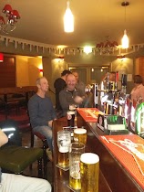
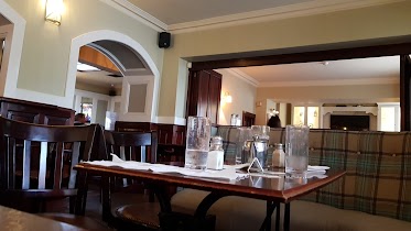
Goldsmiths Pub
3, Quinsborough Road, Bray, IE Ireland
contacts phone
:
+353 1 276 0391
Latitude:
53.2044322
, Longitude:
-6.1085527
larger map & directions
read more
nearest Bar
45 m
The Boomerang Bar
7 Quinsborough Road, Bray
Bar
read more
50 m
Florentine Bar
Main Street, Bray
Bar
read more
78 m
McGettigan's Bray
Main Street, Bray
Bar
read more
193 m
Gusto Italiano
Goldsmith Terrace, 5a Goldsmith Terrace Quinsborough Road, Bray, Quinsborough Road, Bray
Bar
read more
272 m
The Wild Goose
Main Street Main Street, Bray
Bar
read more
379 m
The Ardmore
R761, Bray
Bar
read more
413 m
Duffs
Main St Main Street, Bray
Bar
read more
530 m
The Harbour Bar
1 Strand Road, Bray
Bar
read more
543 m
Hibernia Inn
1, Royal Marine Terrace, Strand Rd, Bray
Bar
read more
615 m
O'Driscolls Seaside Bar
Strand Road, Bray
Bar
read more
709 m
Butler & Barry
Strand Road, Bray
Bar
Restaurant
Food
Point of interest
Establishment
read more
709 m
Butler & Barry Gastro Pub
Bray
Bar
read more
726 m
The Coach Inn
Dublin Road, Little Bray, Bray
Bar
read more
759 m
Porterhouse Bray
Strand Road, Bray
Bar
read more
777 m
Jim Doyle & Sons
Strand Road, Bray
Bar
read more
927 m
Dargle Tavern
Dargle Road, Bray
Bar
read more
1.396 km
Chrissy Ds
Vevay Road, Bray
Bar
read more
3.033 km
Brady's Shankill
Dublin Road R119, Shankill, Dublin
Bar
read more
4.299 km
Enniskerry Inn,The
Enniskerry
Bar
read more
4.398 km
Pluck's of Kilmac
Bray, Kilmacanogue
Bar
read more
12.447 km
Three rock pub
Taylors Hill, Kilmashogue, Dublin 16
Bar
read more
15.77 km
Vintners' Federation of Ireland
V.f.i. House, Castleside Drive, Rathfarnham
Bar
read more
16.726 km
The Irish House Party
The Lansdowne Hotel, 27 Pembroke Road, Dublin 4
Bar
read more
17.976 km
The Camden Sports Bar
84-87 Lwr Camden street d2, Dublin
Bar
read more
17.981 km
Club Chonradh na Gaeilge
6 Harcourt Street, Dublin
Bar
read more
📑
all categories
Accounting
Administrative area level 1
Administrative area level 2
Airport
Amusement park
Aquarium
Art gallery
Atm
Bakery
Bank
Bar
Beauty salon
Bicycle store
Book store
Bowling alley
Bus station
Cafe
Campground
Car dealer
Car rental
Car repair
Car wash
Casino
Cemetery
Church
City hall
Clothing store
Colloquial area
Convenience store
Country
Courthouse
Dentist
Department store
Doctor
Electrician
Electronics store
Embassy
Establishment
Finance
Fire station
Florist
Food
Funeral home
Furniture store
Gas station
General contractor
Grocery or supermarket
Gym
Hair care
Hardware store
Health
Hindu Temple
Home goods store
Hospital
Insurance agency
Jewelry store
Laundry
Lawyer
Library
Light rail station
Liquor store
Local government office
Locality
Locksmith
Lodging
Meal delivery
Meal takeaway
Mosque
Movie rental
Movie theater
Moving company
Museum
Natural feature
Neighborhood
Night club
Painter
Park
Parking
Pet store
Pharmacy
Physiotherapist
Place of worship
Plumber
Point of interest
Police
Political
Post office
Premise
Real estate agency
Restaurant
Roofing contractor
Route
Rv park, camping
School
Shoe store
Shopping mall
Spa
Stadium
Storage
Store
Sublocality
Subpremise
Supermarket
Synagogue
Taxi stand
Train station
Transit station
Travel agency
University
Veterinary care
Zoo
sublocality level 1
↑