IrelandDrogheda
Drogheda
Administrative Region:
County Louth
population:
44 135
calling code:
+353-41
postcode:
A92
Location on the map of Ireland
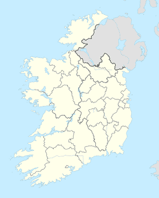
Drogheda
Supermarket


Travel agency


University
Drogheda School of Performing Arts
The Little Duke Theatre, Duke Street, Drogheda

Kumon Maths and English
The Barbican Centre, St. Peter's Parish Centre, 3 William Street, Ballsgrove, Drogheda

Book store

Opening Minds School Book & Toy Shop, Laurence Centre, Drogheda
14 William Street, Drogheda


Pet store


📑 Drogheda all categories
AccountingArt galleryAtmBakeryBankBarBeauty salonBicycle storeBook storeBowling alleyBus stationCafeCar dealerCar rentalCar repairCasinoCemeteryChurchCity hallClothing storeConvenience storeCourthouseDentistDepartment storeDoctorElectricianElectronics storeEstablishmentFinanceFire stationFloristFoodFurniture storeGas stationGeneral contractorGrocery or supermarketGymHair careHardware storeHealthHome goods storeHospitalInsurance agencyJewelry storeLaundryLawyerLibraryLiquor storeLocal government officeLocalityLocksmithLodgingMeal deliveryMeal takeawayMovie rentalMovie theaterMoving companyMuseumNatural featureNeighborhoodNight clubPainterParkParkingPet storePharmacyPhysiotherapistPlace of worshipPlumberPoint of interestPolicePost officePremiseReal estate agencyRestaurantRoofing contractorRouteSchoolShoe storeShopping mallStadiumStorageStoreSubpremiseSupermarketTrain stationTransit stationTravel agencyUniversityVeterinary caresublocality level 1