Lodging nearby 19 Westlands
Ireland
Lodging nearby 19 Westlands
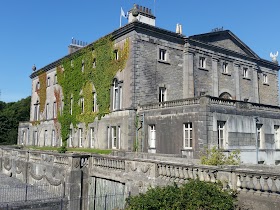
19 Westlands
19 Westlands, The Quay, Westport Ireland
contacts phone
:
+353
Latitude:
53.7973006
, Longitude:
-9.5379463
read more
nearest Lodging
123 m
Quay Lodge B&B
Cloonmonad
Lodging
read more
146 m
Adare House Bed & Breakfast
Quay Road, Westport
Lodging
read more
150 m
Adare House Westport Hotel
Quay Road, Westport
Lodging
read more
372 m
Boffin Lodge
The Quay, Westport
Lodging
read more
378 m
Cloonmonad House
Quay Road, Westport
Lodging
read more
538 m
Mcbrides Terrace Town House
6 Mac Brides Terrace, Westport
Lodging
read more
575 m
Lighthouse Accommodations Westport
Lower Quay, Westport
Lodging
read more
609 m
The Anchorage Apartments
The Quay, Westport
Lodging
read more
664 m
Lurgan House Bed & Breakfast
Lurgan House, Carrownalurgan, Mayo
Lodging
read more
665 m
Cinnamon Wharf
Cloonmonad
Lodging
read more
707 m
Hilltop
1-3 Tober Hill, Cahernamart, Westport
Lodging
read more
718 m
Drummin House
Tober Hill, Westport
Lodging
read more
732 m
The Harbour Mill Apartments
Westport Quay, Westport
Lodging
read more
749 m
Harbour Mill
Westport Quay Westport Co. Mayo
Lodging
read more
749 m
The Harbour Mill
Westport Quay Westport Co. Mayo
Lodging
read more
772 m
The Westport Bit
26 Peter Street, Westport
Lodging
read more
816 m
Westport Coast Hotel
The Quay, Westport
Lodging
read more
819 m
McCarthys Guesthouse B&B
Quay Street, Westport
Lodging
read more
872 m
The Wyatt Hotel
The Octagon, Westport
Lodging
read more
888 m
Westport Hotels In1
10 Octagon, Westport
Lodging
read more
917 m
Nephin Lodge B&B
Leenane Road, Westport
Lodging
read more
930 m
The Quays
The Quay Harbour View, Cloonmonad, Westport Quay
Lodging
read more
976 m
The Old Mill Holiday Hostel
Barracks Yard, James Street, Westport
Lodging
read more
979 m
Glenderan B&B Westport
Rosbeg, Westport
Lodging
read more
1.054 km
Old Mill Town Centre Apartments
James Street (Units #2 and #9), Westport
Lodging
read more
📑
all categories
Accounting
Administrative area level 1
Administrative area level 2
Airport
Amusement park
Aquarium
Art gallery
Atm
Bakery
Bank
Bar
Beauty salon
Bicycle store
Book store
Bowling alley
Bus station
Cafe
Campground
Car dealer
Car rental
Car repair
Car wash
Casino
Cemetery
Church
City hall
Clothing store
Colloquial area
Convenience store
Country
Courthouse
Dentist
Department store
Doctor
Electrician
Electronics store
Embassy
Establishment
Finance
Fire station
Florist
Food
Funeral home
Furniture store
Gas station
General contractor
Grocery or supermarket
Gym
Hair care
Hardware store
Health
Hindu Temple
Home goods store
Hospital
Insurance agency
Jewelry store
Laundry
Lawyer
Library
Light rail station
Liquor store
Local government office
Locality
Locksmith
Lodging
Meal delivery
Meal takeaway
Mosque
Movie rental
Movie theater
Moving company
Museum
Natural feature
Neighborhood
Night club
Painter
Park
Parking
Pet store
Pharmacy
Physiotherapist
Place of worship
Plumber
Point of interest
Police
Political
Post office
Premise
Real estate agency
Restaurant
Roofing contractor
Route
Rv park, camping
School
Shoe store
Shopping mall
Spa
Stadium
Storage
Store
Sublocality
Subpremise
Supermarket
Synagogue
Taxi stand
Train station
Transit station
Travel agency
University
Veterinary care
Zoo
sublocality level 1
↑