Lodging nearby San Antonio B&B
Ireland
Lodging nearby San Antonio B&B
San Antonio B&B
Castlecomer Road, Kilkenny, IE Ireland
contacts phone
:
+353
Latitude:
52.6633635
, Longitude:
-7.2512823
larger map & directions
read more
nearest Lodging
37 m
Park Villa B & B
100 Castlecomer Road, Kilkenny
Lodging
read more
94 m
Rosquil House B&B
Kilkenny
Lodging
read more
162 m
The Nore River House
2-3 Castlecomer Road, Newpark Lower
Lodging
read more
162 m
Newpark Hotel
Castlecomer Road, Kilkenny
Lodging
read more
170 m
Cleeres B& B
Green's Hill, Kilkenny
Lodging
read more
361 m
Chaplins of Kilkenny
Castlecomer Road, Kilkenny
Lodging
read more
438 m
Glendine Inn
Castlecomer Road, Kilkenny
Lodging
read more
509 m
Glendine House Bed & Breakfast
Glendine, Kilkenny
Lodging
read more
550 m
Pinecrest Bed and Breakfast
Bishops Meadows, Freshford Road, Kilkenny
Lodging
read more
612 m
Alton
Bishopshill, Freshford Road, Kilkenny
Lodging
read more
647 m
Viewmount House B&B
Castlecomer Road, Kilkenny
Lodging
read more
671 m
Bridgecourt House
Green Street, Kilkenny
Lodging
read more
688 m
Bambricks Troysgate House
Vicar Street
Lodging
read more
691 m
Troysgate House
Troy's Gate, Kilkenny
Lodging
read more
771 m
Troysgate House
Vicar Street
Lodging
read more
780 m
Kilkenny Inn Hotel
15 Vicar Street, Kilkenny
Lodging
read more
810 m
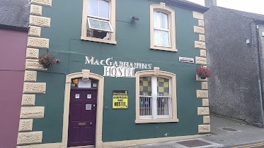
MacGabhainns Backpackers Hostel
24 Vicar Street, Kilkenny
Lodging
read more
852 m
Ormonde Tourist Hostel
12 Barrack Street, Kilkenny
Lodging
read more
950 m
Dunboy Bed & Breakfast
10 Parkview Drive, Kilkenny
Lodging
read more
955 m
Bregagh House
Dean Street, Kilkenny
Lodging
read more
955 m
Bregagh House
18 Dean Street, Kilkenny
Lodging
read more
973 m
Kilkenny Tourist Hostel
35 Parliament Street, Kilkenny
Lodging
read more
1.02 km
JBs Bar & Guest Accommodation
42 John Street Upper, Kilkenny
Lodging
read more
1.085 km
Moate Farm
Talbot's Inch Village, Freshford
Lodging
read more
1.102 km
Kilkenny House Hotel
Talbot's Inch Village, Freshford Road, Kilkenny
Lodging
read more
📑
all categories
Accounting
Administrative area level 1
Administrative area level 2
Airport
Amusement park
Aquarium
Art gallery
Atm
Bakery
Bank
Bar
Beauty salon
Bicycle store
Book store
Bowling alley
Bus station
Cafe
Campground
Car dealer
Car rental
Car repair
Car wash
Casino
Cemetery
Church
City hall
Clothing store
Colloquial area
Convenience store
Country
Courthouse
Dentist
Department store
Doctor
Electrician
Electronics store
Embassy
Establishment
Finance
Fire station
Florist
Food
Funeral home
Furniture store
Gas station
General contractor
Grocery or supermarket
Gym
Hair care
Hardware store
Health
Hindu Temple
Home goods store
Hospital
Insurance agency
Jewelry store
Laundry
Lawyer
Library
Light rail station
Liquor store
Local government office
Locality
Locksmith
Lodging
Meal delivery
Meal takeaway
Mosque
Movie rental
Movie theater
Moving company
Museum
Natural feature
Neighborhood
Night club
Painter
Park
Parking
Pet store
Pharmacy
Physiotherapist
Place of worship
Plumber
Point of interest
Police
Political
Post office
Premise
Real estate agency
Restaurant
Roofing contractor
Route
Rv park, camping
School
Shoe store
Shopping mall
Spa
Stadium
Storage
Store
Sublocality
Subpremise
Supermarket
Synagogue
Taxi stand
Train station
Transit station
Travel agency
University
Veterinary care
Zoo
sublocality level 1
↑