Lodging nearby Store/Outhouse
Ireland
Lodging nearby Store/Outhouse
Store/Outhouse
17, Lombard Street, X91 YR12, Waterford, IE Irlandia
contacts phone
:
+353
Latitude:
52.259668
, Longitude:
-7.1046443
larger map & directions
read more
nearest Lodging
114 m
Adelphi Wharf
7 Adelphi Quay, Waterford
Lodging
read more
131 m
Bolton House Hostel
Beau Street, Waterford
Lodging
read more
240 m
Sherlock House
Catherine Street, Waterford
Lodging
read more
241 m
Waterford Marina Hotel
Canada Street, Waterford
Lodging
read more
252 m
Avondale Guest Accommodation
2 Parnell Street, Waterford
Lodging
read more
371 m
فندق كولونيا
وتَرفورد،
Lodging
read more
371 m
Wateford
Waterford
Lodging
read more
371 m
Glenraha Farmhouse
Waterford
Lodging
read more
484 m
Athenaeum House Hotel
Christendom
Lodging
read more
540 m
Trinity Apartments
Alexander Street 2c Apartment, Waterford City
Lodging
read more
569 m
Trinity Apartments
Alexander Street, Waterford
Lodging
read more
763 m
The Waterford Hostel
70 Manor Street, Waterford
Lodging
read more
820 m
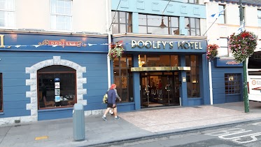
Dooley's Hotel Waterford
36 Merchants Quay, Waterford
Lodging
read more
820 m
Dooley's Hotel
The Quay, Waterford
Lodging
read more
826 m
Dooley's Hotel Waterford
30 Merchants Quay, Waterford
Lodging
read more
882 m
Mcguire House
Bath Street, Waterford
Lodging
read more
919 m
Seyi's
Grange Terrace, 7, Ballytruckle Road, Waterford
Lodging
read more
926 m
Sal's Bed and Breakfast
17-18 Merchants Quay, Waterford
Lodging
read more
926 m
Sal's Bed and Breakfast
17 Merchants Quay, Waterford
Lodging
read more
971 m
The Barley Field
35-36 Barrack Street, Waterford
Lodging
read more
1.048 km
Bridge
Merchants Quay, Waterford
Lodging
read more
1.048 km
The Anchorage Guest House
9 Merchants Quay, Waterford
Lodging
read more
1.048 km
The Day's Inn
Merchants Quay, Waterford
Lodging
read more
1.048 km
The Anchorage Guesthouse
9 Merchants Quay, Waterford
Lodging
read more
1.234 km
St Albans BB
Tramore Road, Waterford
Lodging
read more
📑
all categories
Accounting
Administrative area level 1
Administrative area level 2
Airport
Amusement park
Aquarium
Art gallery
Atm
Bakery
Bank
Bar
Beauty salon
Bicycle store
Book store
Bowling alley
Bus station
Cafe
Campground
Car dealer
Car rental
Car repair
Car wash
Casino
Cemetery
Church
City hall
Clothing store
Colloquial area
Convenience store
Country
Courthouse
Dentist
Department store
Doctor
Electrician
Electronics store
Embassy
Establishment
Finance
Fire station
Florist
Food
Funeral home
Furniture store
Gas station
General contractor
Grocery or supermarket
Gym
Hair care
Hardware store
Health
Hindu Temple
Home goods store
Hospital
Insurance agency
Jewelry store
Laundry
Lawyer
Library
Light rail station
Liquor store
Local government office
Locality
Locksmith
Lodging
Meal delivery
Meal takeaway
Mosque
Movie rental
Movie theater
Moving company
Museum
Natural feature
Neighborhood
Night club
Painter
Park
Parking
Pet store
Pharmacy
Physiotherapist
Place of worship
Plumber
Point of interest
Police
Political
Post office
Premise
Real estate agency
Restaurant
Roofing contractor
Route
Rv park, camping
School
Shoe store
Shopping mall
Spa
Stadium
Storage
Store
Sublocality
Subpremise
Supermarket
Synagogue
Taxi stand
Train station
Transit station
Travel agency
University
Veterinary care
Zoo
sublocality level 1
↑